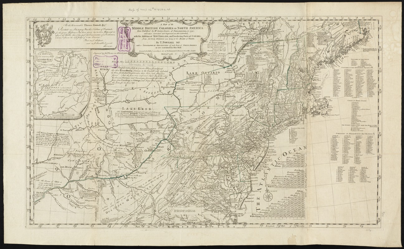
A map of the middle British colonies in North America : first published by Mr. Lewis Evans, of Philadelphia, in 1755; and since corrected and improved, as also extended, with the addition of New England, and bordering parts of Canada; from actual surveys now lying at the Board of Trade
A map of the middle British colonies in North America
Item Information
Title:
A map of the middle British colonies in North America : first published by Mr. Lewis Evans, of Philadelphia, in 1755; and since corrected and improved, as also extended, with the addition of New England, and bordering parts of Canada; from actual surveys now lying at the Board of Trade
Relief shown pictorially.
Prime meridian: London and Philadelphia.
Includes text, list of townships, distance charts, and inset "A sketch of the remaining part of Ohio R. &c."
Conservation of this piece was funded by Lavinia Lee Witt Touchton of Tampa, Florida in memory of her father, Currie B. Witt, whose study of Benjamin Franklin was a positive influence in his life.
Boston Public Library copy in portfolio with a map of the Gulf Stream once belonging to Benjamin Franklin. Note reads: "These maps belonged to a lot brought by Dr. Franklin from Europe, and are given to this Library by Dr. Thomas Hewson Bache, 233 South 13th St., Phil. Recd. this Dr. S.A. Green."