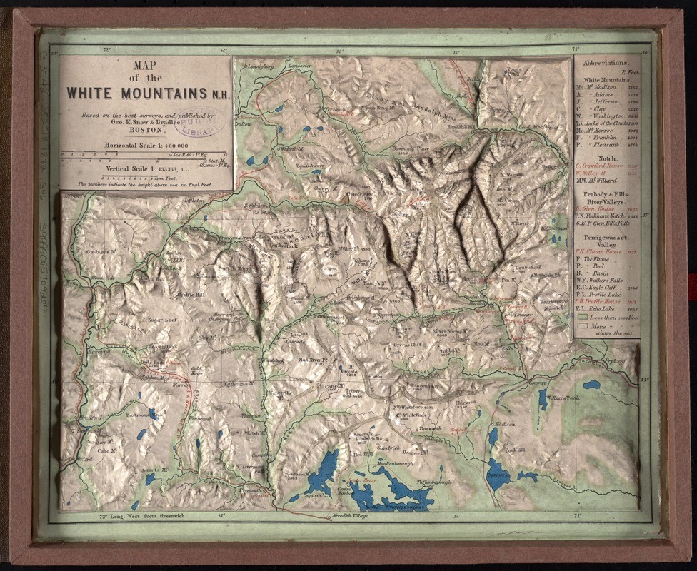
Map of the White Mountains, N.H : based on the best surveys
Map of the White Mountains, N.H
Item Information
Title:
Map of the White Mountains, N.H : based on the best surveys
Title (alt.):
Relief map of the White Mountains
Description:
Three-dimensional relief maps are visual aids that assist schoolchildren in understanding physical terrain. The first relief maps were created in China, and appeared in Europe in the late 18th century. This late 19th century map of the White Mountains, published in Boston, allows the viewer to grasp the mountainous terrain of northern New Hampshire.
Raised relief model.
Relief also shown by spot heights.
Includes list of points of interest with elevations.
Travel information on cover.
Notes (date):
This date is inferred.
Notes (exhibitions):
Exhibited: "Crossing Boundaries: Art // Maps" organized by the Norman B. Leventhal Map & Education Center at the Boston Public Library, 2018-2019.
Exhibited: "Back to School: Geography in the Classroom" organized by the Norman B. Leventhal Map Center at the Boston Public Library, 2014-2015.