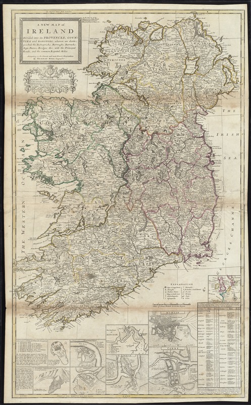
A new map of Ireland divided into its provinces, counties and baronies, wherein are distinguished the bishopricks, borroughs, barracks, bogs, passes, bridges &c. with the principal roads, and the common reputed miles
A new map of Ireland divided into its provinces, counties and baronies, wherein are distinguished the bishopricks, borroughs, barracks, bogs, passes, bridges &c. with the principal roads, and the common reputed miles
Item Information
Title:
A new map of Ireland divided into its provinces, counties and baronies, wherein are distinguished the bishopricks, borroughs, barracks, bogs, passes, bridges &c. with the principal roads, and the common reputed miles
Relief shown pictorially.
Dedication: To His Grace Charles Duke of Shrewsbury, Ld. High Treasurer of Great Britain, Ld. Chamberlain of His Majesty's Houshold, Ld. Leutenant General and General Governor of Ireland, Knight of ye Most Noble Order of the Garter &c. this map is humbly dedicated by your Grace's most humble Servant H. Moll Geographer, 1714.
Insets: [Northwestern Europe] -- Dublin -- Corke -- The harbour of Kinsale -- Limrick -- Waterford -- Gallway -- Isle of St. Patrick's Purgatory in the county of Dunnagall -- Gyants Cawsway in the county of Antrim.
Includes table: A catalogue of ye towns & places, where barracks are erected ....
Appears in Moll's The world described, [1709-1736], plate 19.