Skip to search
Skip to main content
Digital Commonwealth
Sign Up / Log In
Search for
Search
Search
Search
Basic
Advanced
Explore
Map
Collections
Institutions
Formats
For Educators
Primary Source Sets
Lesson Plans
Using Primary Sources
Searching Digital Commonwealth
For Institutions
Join Digital Commonwealth
Conferences, Trainings, & Events
How to Contribute Collections
Digitization Services
Board & Committees
Frequently Asked Questions
About
About Digital Commonwealth
News & Announcements
Copyright & Terms of Use
Harmful Content Statement
Partners
API
Contact Us
Boston Public Library
Norman B. Leventhal Map Center Collection
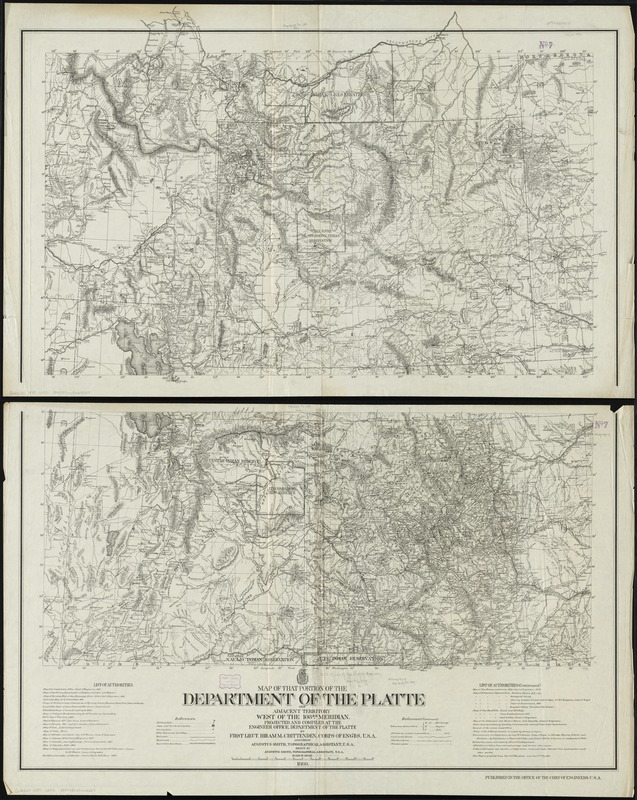
Map of that portion of the Department of the Platte and adjacent territory west of the 103rd meridian
Map of that portion of the Department of the Platte and adjacent territory west of the 103rd meridian
×
Item Information
Title:
Map of that portion of the Department of the Platte and adjacent territory west of the 103rd meridian
Creator:
United States. Army. Corps of Engineers
Name on Item:
projected and compiled by Hiram M. Chittenden, assisted by Augustus Smith ; drawn by Augustus Smith.
Date:
1889
Format:
Maps/Atlases
Location:
Boston Public Library
Norman B. Leventhal Map Center
Collection (local):
Norman B. Leventhal Map Center Collection
Subjects:
United States. Army. Dept. of the Platte--Maps
Indian reservations--Pacific and Mountain States--Maps
Pacific and Mountain States--Maps
Places:
Mountain Region
(area)
Pacific Coast
(area)
Extent:
1 map on 2 sheets ; 132 x 106 cm., on sheets 72 x 115 cm.
Permalink:
https://ark.digitalcommonwealth.org/ark:/50959/cj82kq189
Terms of Use:
No known copyright restrictions.
No known restrictions on use.
Publisher:
[Washington, D.C.] : Office of the Chief of Engineers
Scale:
Scale [ca. 1:1,000,000]
Language:
English
Notes:
Covers Idaho, Wyoming, Utah, and Colorado.
Prime meridians: Washington and Greenwich.
Relief shown by hachures and spot heights.
Also shows indian reservations.
Includes list of authorities.
Identifier:
06_01_009270
Call #:
G4220 1889 .U55
Barcode:
39999065660027
show more...
View MODS XML
More Like This
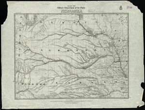
Map of military Department of the Platte, Nebraska
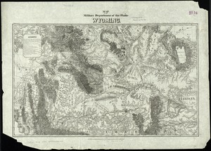
Map of the military Department of the Platte Wyoming
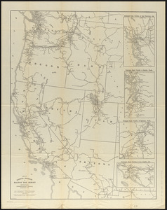
Map eighth division railway mail service
Map of Oregon and upper California, from the surveys of John ...
Find More Like This >>
Tools
Share
Facebook
Pinterest
X
Reddit
Tumblr
Email
Copy link
Add to Folder
Questions/Comments
Cite This Item
IIIF Manifest
Downloads
Primary (full resolution, uncompressed)
(TIF, 594 MB)
Large (full resolution)
(JPEG, 49.9 MB)
Medium
(JPEG, 231 KB)