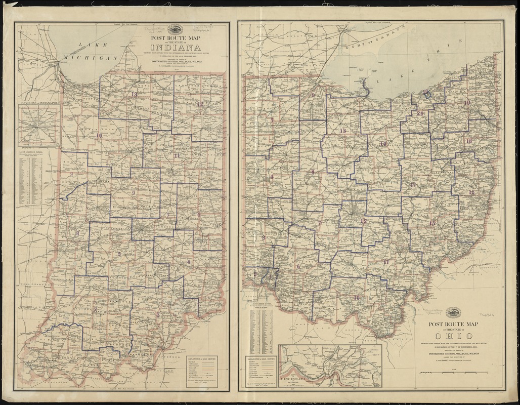
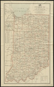
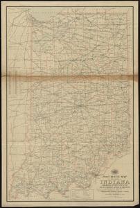
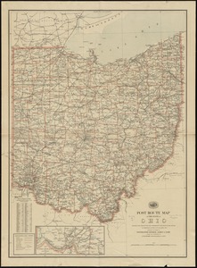
Post route map of the State of Ohio showing post offices with the intermediate distances and mail routes in operation on the 1st of December, 1895 ; Post route map of the State of Indiana showing post offices with the intermediate distances and mail routes in operation on the 1st of December, 1895
Post route map of the State of Ohio showing post offices with the intermediate distances and mail routes in operation on the 1st of December, 1895 ; Post route map of the State of Indiana showing post offices with the intermediate distances and mail routes in operation on the 1st of December, 1895
Item Information
Title:
Post route map of the State of Ohio showing post offices with the intermediate distances and mail routes in operation on the 1st of December, 1895 ; Post route map of the State of Indiana showing post offices with the intermediate distances and mail routes in operation on the 1st of December, 1895
Title (alt.):
Post route map of the State of Indiana showing post offices with the intermediate distances and mail routes in operation on the 1st of December, 1895
Also shows railroads, counties, and [congressional districts?].
Insets: Environs of Indianapolis -- City of Cincinnati and environs.
Includes lists of counties showing relative position.
"The service on this diagram brought up to date of Dec. 1st. 1895."