Skip to search
Skip to main content
Digital Commonwealth
Sign Up / Log In
Search for
Search
Search
Search
Basic
Advanced
Explore
Map
Collections
Institutions
Formats
For Educators
Primary Source Sets
Lesson Plans
Using Primary Sources
Searching Digital Commonwealth
For Institutions
Join Digital Commonwealth
Conferences, Trainings, & Events
How to Contribute Collections
Digitization Services
Board & Committees
Frequently Asked Questions
About
About Digital Commonwealth
News & Announcements
Copyright & Terms of Use
Harmful Content Statement
Partners
API
Contact Us
Washington Historical Commission
Washington Historical Commission Collection
1798 Map of Washington
1798 Map of Washington
×
Item Information
Title:
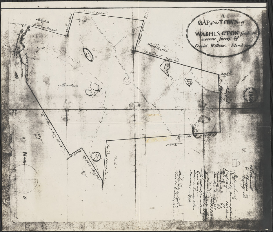
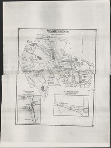
1798 Map of Washington
Surveyor:
Willcox, Daniel
Name on Item:
from an accurate survey by Daniel Wilcox
Date:
1798
Format:
Maps/Atlases
Location:
Washington Historical Commission
Collection (local):
Messenger Collection
Places:
Massachusetts
>
Berkshire (county)
>
Washington
Extent:
1 map ; 45 x 39 cm
Permalink:
https://ark.digitalcommonwealth.org/ark:/50959/c247kw82p
Terms of Use:
No known copyright restrictions.
No known restrictions on use.
Notes:
Title supplied by cataloger.
On Map: A Map of the Town of Washington from an accurate survey by Daniel Willcox March 1798.
Notes (date):
Date from item or accompanying material.
Notes (object):
Copy of map
Identifier:
WHC0484
show more...
View MODS XML
More Like This
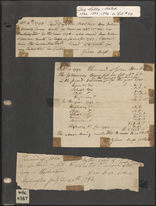
1700s Tax Record for John Hooker
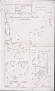
1757 Map of Washington
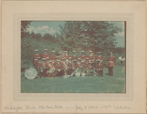
175th Celebration, Eagles Military Band
1876 Map of Washington
Find More Like This >>
Tools
Share
Facebook
Pinterest
X
Reddit
Tumblr
Email
Copy link
Add to Folder
Questions/Comments
Cite This Item
Downloads
Primary (full resolution, uncompressed)
(TIF, 101 MB)
Large (full resolution)
(JPEG, 8.45 MB)
Medium
(JPEG, 289 KB)