Skip to search
Skip to main content
Digital Commonwealth
Sign Up / Log In
Search for
Search
Search
Search
Basic
Advanced
Explore
Map
Collections
Institutions
Formats
For Educators
Primary Source Sets
Lesson Plans
Using Primary Sources
Searching Digital Commonwealth
For Institutions
Join Digital Commonwealth
Conferences, Trainings, & Events
How to Contribute Collections
Digitization Services
Board & Committees
Frequently Asked Questions
About
About Digital Commonwealth
News & Announcements
Copyright & Terms of Use
Harmful Content Statement
Partners
API
Contact Us
Boston Public Library
Norman B. Leventhal Map Center Collection
/
Boston and New England Maps (Collection of Distinction)
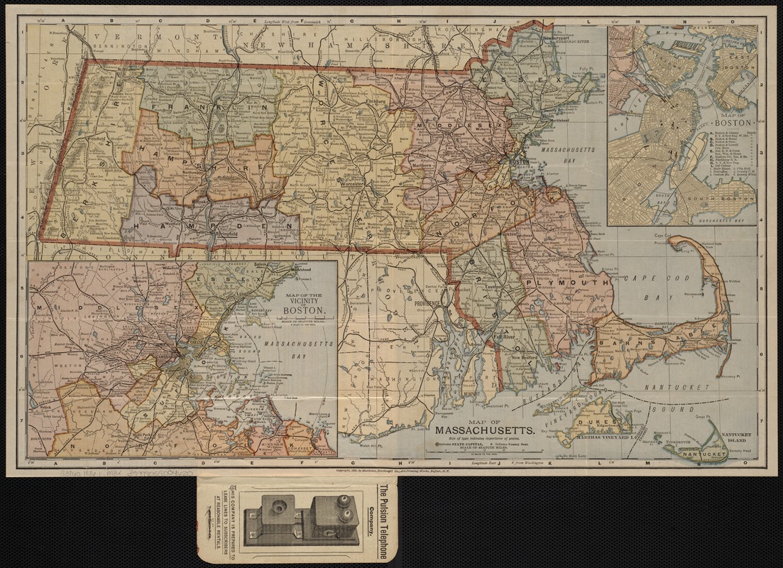
Map of Massachusetts
Map of Massachusetts
×
Item Information
Title:
Map of Massachusetts
Cover title :
King's annotated map, Massachusetts
Creator:
Matthews-Northrup Company
Date:
[ca. 1886]
Format:
Maps/Atlases
Location:
Boston Public Library
Norman B. Leventhal Map Center
Collection (local):
Norman B. Leventhal Map Center Collection
Subjects:
Massachusetts--Maps
Places:
Massachusetts
Extent:
1 map : col. ; 30 x 50 cm. + cover
Permalink:
https://ark.digitalcommonwealth.org/ark:/50959/9s161g77h
Terms of Use:
No known copyright restrictions.
No known restrictions on use.
Publisher:
Buffalo, N.Y : Matthews-Northrup
Scale:
Scale 1:633,600.
Language:
English
Notes:
Published for the Pulsion Telephone Company, Boston.
Includes insets: Map of Boston and Map of the vicinity of Boston.
On verso: index, text, statistics, etc.
Identifier:
06_01_004167
Call #:
G3760 1886.1 .M3x
Barcode:
39999059004620
show more...
View MODS XML
More Like This
The 100th anniversary map of Abraham Lincoln's visit to ...
Annexation map
Automobile map of Massachusetts : central section
Bicycle map of Massachusetts
Find More Like This >>
Tools
Share
Facebook
Pinterest
X
Reddit
Tumblr
Email
Copy link
Add to Folder
Questions/Comments
Cite This Item
IIIF Manifest
Downloads
Primary (full resolution, uncompressed)
(TIF, 44.6 MB)
Large (full resolution)
(JPEG, 3.75 MB)
Medium
(JPEG, 414 KB)
GeoTIFF (georeferenced)
(TIF, 52.4 MB)