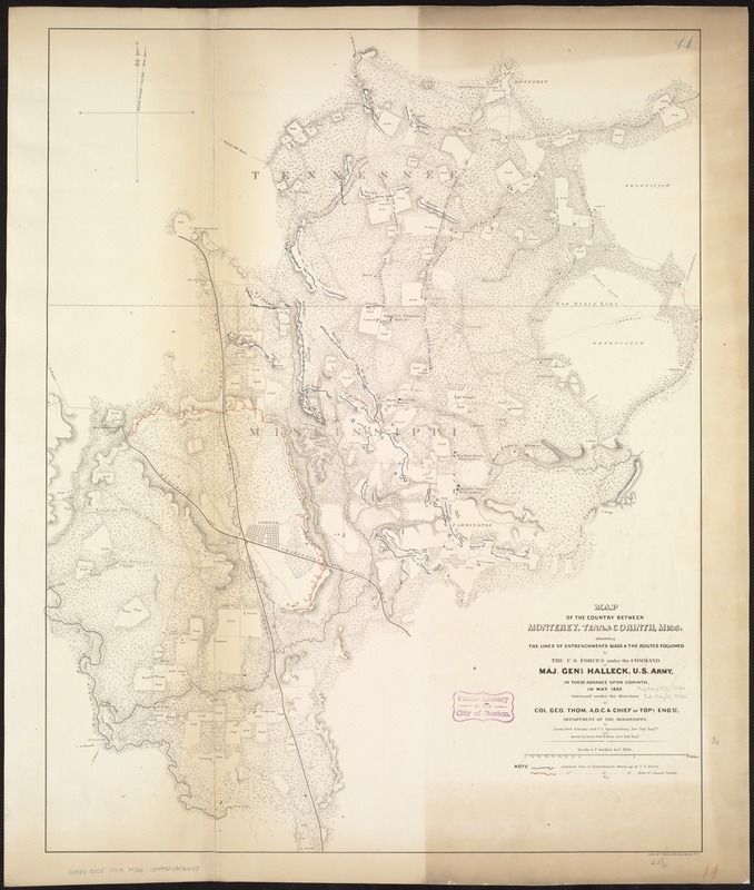
Map of the country between Monterey, Tenn: & Corinth, Miss: showing the lines of entrenchments made & the routes followed by the U.S. forces under the command of Maj. Genl. Halleck, U.S. Army, in their advance upon Corinth in May 1862
Map of the country between Monterey, Tenn: & Corinth, Miss: showing the lines of entrenchments made & the routes followed by the U.S. forces under the command of Maj. Genl. Halleck, U.S. Army, in their advance upon Corinth in May 1862
Item Information
Title:
Map of the country between Monterey, Tenn: & Corinth, Miss: showing the lines of entrenchments made & the routes followed by the U.S. forces under the command of Maj. Genl. Halleck, U.S. Army, in their advance upon Corinth in May 1862
Surveyed under the direction of Col. Geo. Thom, A.D.C. & Chief of Topl. Engrs., Department of the Mississippi, by Lieuts. Fred. Schraag and C. L. Spangenberg, Asst. Topl. Engrs. and drawn by Lieut. Otto H. Matz, Asst. Topl. Engr.
Includes houses, names of residents, fences, roads, railroads, vegetation, fields, drainage, and relief by hachures.
Description derived from published bibliography.