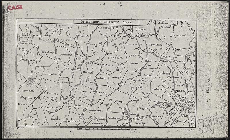
Map of Middlesex County : compiled from the latest authorities embracing the recent surveys of the state for railways and canals
Map of Middlesex County
Item Information
Title:
Map of Middlesex County : compiled from the latest authorities embracing the recent surveys of the state for railways and canals
Description:
Black and white reduced copy of Middlesex County showing some major roads, waterways, and hills by name, and church buildings as they existed c. 1830. It also shows the population of the towns in 1820 and 1830.The mileage from Boston to each town is given. Cartographer is James G. Carter and the printer is Hillard and Brown of Cambridge, Mass.