Skip to search
Skip to main content
Digital Commonwealth
Sign Up / Log In
Search for
Search
Search
Search
Basic
Advanced
Explore
Map
Collections
Institutions
Formats
For Educators
Primary Source Sets
Lesson Plans
Using Primary Sources
Searching Digital Commonwealth
For Institutions
Join Digital Commonwealth
Conferences, Trainings, & Events
How to Contribute Collections
Digitization Services
Board & Committees
Frequently Asked Questions
About
About Digital Commonwealth
News & Announcements
Copyright & Terms of Use
Harmful Content Statement
Partners
API
Contact Us
Boston Public Library
Norman B. Leventhal Map Center Collection
/
American Revolutionary War-Era Maps (Collection of Distinction)
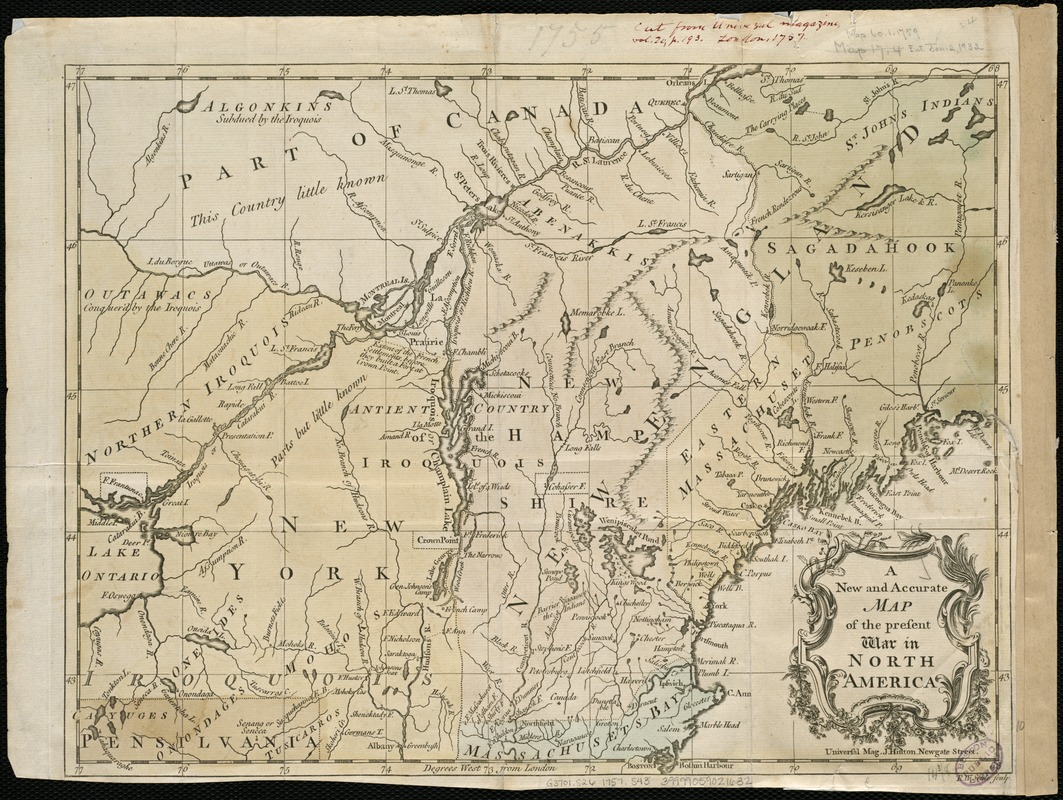
A new and accurate map of the present war in North America
A new and accurate map of the present war in North America
×
Item Information
Title:
A new and accurate map of the present war in North America
Creator:
Seale, Richard William.
Name on Item:
R.W. Seale, sculp.
Date:
[1757?]
Format:
Maps/Atlases
Location:
Boston Public Library
Norman B. Leventhal Map Center
Collection (local):
Norman B. Leventhal Map Center Collection
Subjects:
Northeastern States--History--French and Indian War, 1755-1763--Maps--Early works to 1800
North America--History--French and Indian War, 1755-1763--Maps--Early works to 1800
United States--History--French and Indian War, 1754-1763--Maps--Early works to 1800
Places:
Northeastern United States
(area)
Extent:
1 map : hand col. ; 28 x 36 cm.
Permalink:
https://ark.digitalcommonwealth.org/ark:/50959/8049g963g
Terms of Use:
No known copyright restrictions.
No known restrictions on use.
Publisher:
[London] : J. Hinton
Scale:
Scale [ca. 1:2,000,000]
Language:
English
Notes:
Relief shown pictorially.
Prime meridian: London.
"Universal mag. J. Hinton, Newgate Street."
Identifier:
06_01_006231
Call #:
G3701.S26 1757 .S43
Barcode:
39999059021632
show more...
View MODS XML
More Like This
A correct plan of the environs of Quebec, and of the battle fought ...
A general map of North America : in which is express'd the several ...
A map of the country between Will's Creek & Monongahela River ...
A map of the several dispositions of the English Fleet & Army on ...
Find More Like This >>
Tools
Share
Facebook
Pinterest
X
Reddit
Tumblr
Email
Copy link
Add to Folder
Questions/Comments
Cite This Item
IIIF Manifest
Downloads
Primary (full resolution, uncompressed)
(TIF, 41.1 MB)
Large (full resolution)
(JPEG, 3.45 MB)
Medium
(JPEG, 376 KB)