Skip to search
Skip to main content
Digital Commonwealth
Sign Up / Log In
Search for
Search
Search
Search
Basic
Advanced
Explore
Map
Collections
Institutions
Formats
For Educators
Primary Source Sets
Lesson Plans
Using Primary Sources
Searching Digital Commonwealth
For Institutions
Join Digital Commonwealth
Conferences, Trainings, & Events
How to Contribute Collections
Digitization Services
Board & Committees
Frequently Asked Questions
About
About Digital Commonwealth
News & Announcements
Copyright & Terms of Use
Harmful Content Statement
Partners
API
Contact Us
Boston Public Library
Boston Redevelopment Authority Collection
/
Urban Maps (Collection of Distinction)
/
Boston and New England Maps (Collection of Distinction)
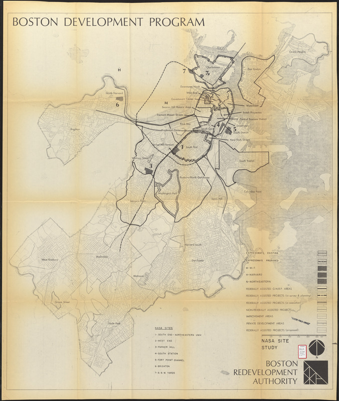
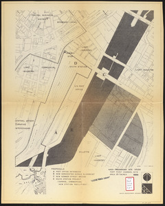
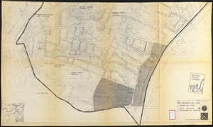
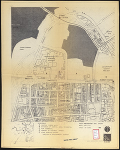
NASA Electronic Research Center : evaluation of proposed sites in Boston
Viewing image 1 of 7
Next >
NASA Electronic Research Center
×
Next
Item Information
Title:
NASA Electronic Research Center : evaluation of proposed sites in Boston
Description:
Part of a report on proposed sites in Boston for a National Aeronautics and Space Administration (NASA) research facility.
Cartographer:
Boston Redevelopment Authority
Name on Item:
Boston Redevelopment Authority
Date:
April 29, 1964
Format:
Maps/Atlases
Location:
Boston Public Library
Central Library in Copley Square
Collection (local):
Boston Public Library Collection
Subjects:
Boston (Mass.)--Maps
City planning--Massachusetts--Boston--Maps
Aeronautical laboratories--Massachusetts--Boston--Maps
United States. National Aeronautics and Space Administration
Places:
Massachusetts
>
Suffolk (county)
>
Boston
Extent:
7 maps ; 105 x 91 cm or smaller
Permalink:
https://ark.digitalcommonwealth.org/ark:/50959/7h14cw68v
Terms of Use:
No known copyright restrictions.
No known restrictions on use.
Publisher:
[Boston] : Boston Revelopment Authority
Scale:
Scales differ
Language:
English
Table of Contents:
NASA site study
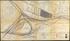
[B & M. yards]
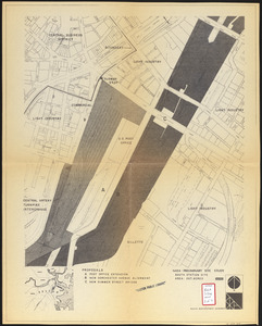
South Station site
Brighton
Fort Point Channel site
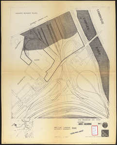
Parker Hill site
West End site
Referenced by:
http://bpl.bibliocommons.com/item/show/1033974075
Identifier:
06_01_017226A
06_01_017226B
06_01_017226D
06_01_017226E
06_01_017226F
06_01_017226C
06_01_017226G
Call #:
BRA/3714 MAPS
Barcode:
mq6330688
show more...
View MODS XML
More Like This
1975 general land use plan
Boston thorofare plan existing routes and proposals
Campus High School urban renewal area Mass. r- : locality map ...
Campus High School urban renewal area Mass. r- : locality map ...
Find More Like This >>
Tools
Share
Facebook
Pinterest
X
Reddit
Tumblr
Email
Copy link
Add to Folder
Questions/Comments
Cite This Item
IIIF Manifest
Downloads
Primary (full resolution, uncompressed)
(TIF, multi-file ZIP, 822 MB)
Large (full resolution)
(JPEG, multi-file ZIP, 7.26 MB)
Medium
(JPEG, multi-file ZIP, 1.82 MB)