Map of the public land states and territories : constructed from the Public Surveys and other official sources in the General Land Office
Map of the public land states and territories
Item Information
Title:
Map of the public land states and territories : constructed from the Public Surveys and other official sources in the General Land Office
Description:
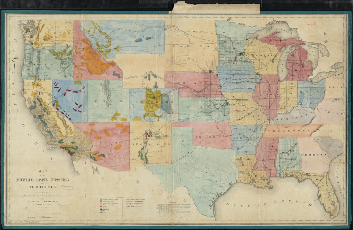
America Transformed: This map, one of the first thematic maps of the United States published by the General Land Office, provided an inventory of the nation’s land and mineral resources. Besides showing the extent of township surveys, it locates local land offices and completed, uncompleted, and projected railroads. In addition, it uses color coding to identify the locations of six mineral resources – gold (yellow), silver (red), copper (green), quicksilver (blue), tin (purple) and coal (gray) – primarily covering extensive areas of the western states and territories. Ignoring the presence of Native peoples in this region, the map suggests that the minerals are readily available for exploitation.
Relief shown by hachures.
Manuscript coloring showing Offices and metallic resources.
Notes (exhibitions):
Exhibited: "America transformed. Part 1: the United States expands westward," organized by the Norman B. Leventhal Map & Education Center at the Boston Public Library, 2019.