Skip to search
Skip to main content
Digital Commonwealth
Sign Up / Log In
Search for
Search
Search
Search
Basic
Advanced
Explore
Map
Collections
Institutions
Formats
For Educators
Primary Source Sets
Lesson Plans
Using Primary Sources
Searching Digital Commonwealth
For Institutions
Join Digital Commonwealth
Conferences, Trainings, & Events
How to Contribute Collections
Digitization Services
Board & Committees
Frequently Asked Questions
About
About Digital Commonwealth
News & Announcements
Copyright & Terms of Use
Harmful Content Statement
Partners
API
Contact Us
Boston Public Library
Norman B. Leventhal Map Center Collection
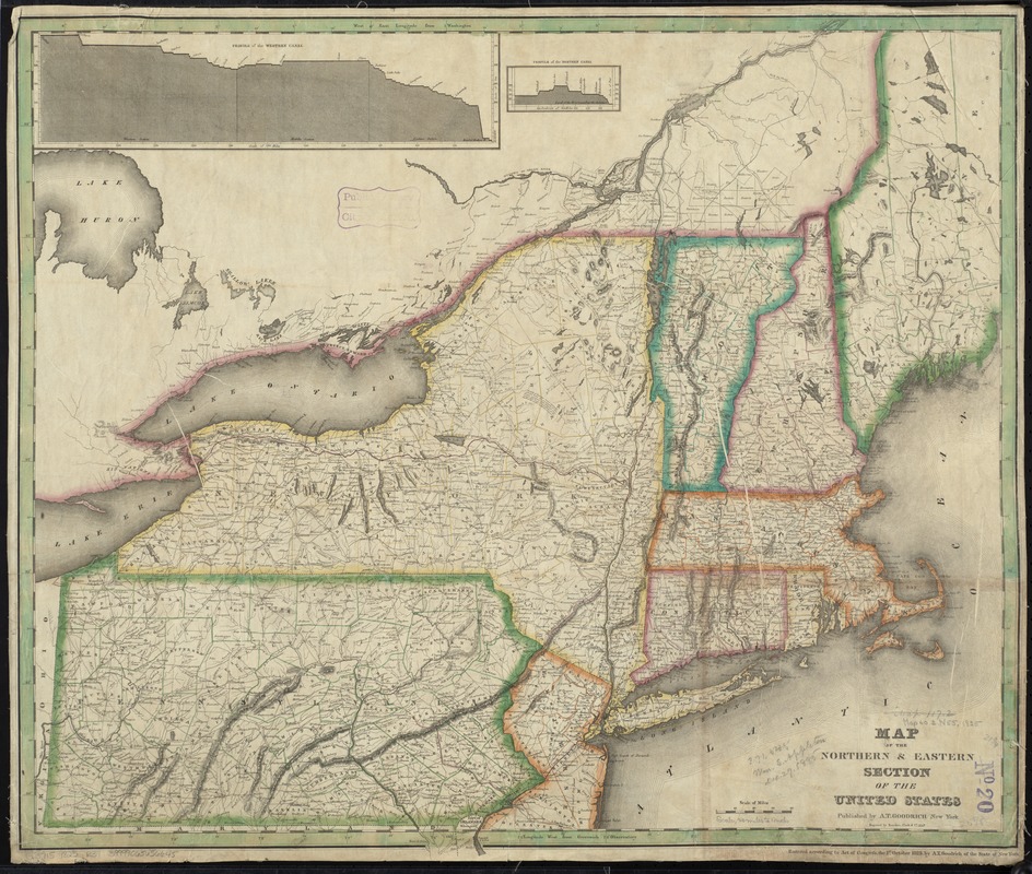
Map of the northern & eastern section of the United States
Map of the northern & eastern section of the United States
×
Item Information
Title:
Map of the northern & eastern section of the United States
Title (alt.):
Map of the northern and eastern section of the United States
Creator:
Rawdon, Clark & Co
Name on Item:
engraved by Rawdon, Clark & Co.
Date:
1825
Format:
Maps/Atlases
Location:
Boston Public Library
Norman B. Leventhal Map Center
Collection (local):
Norman B. Leventhal Map Center Collection
Subjects:
Canals--New York (State)--Maps
Northeastern States--Maps
Places:
Northeastern United States
(area)
New York
Extent:
1 map : hand col. ; 56 x 66 cm.
Permalink:
https://ark.digitalcommonwealth.org/ark:/50959/7h14b203w
Terms of Use:
No known copyright restrictions.
No known restrictions on use.
Publisher:
New York : A.T. Goodrich
Scale:
Scale [ca. 1,280,000]
Language:
English
Notes:
Entered according to Act of Congress, the 1st October 1825, by A.T. Goodrich of the state of New York.
Prime meridians: Greenwich and Washington.
Relief shown by hachures.
Insets: Profile of the western canal -- Profile of the northern canal.
Identifier:
06_01_008719
Call #:
G3715 1825 .R39
Barcode:
39999065656645
show more...
View MODS XML
More Like This
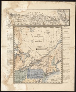
Map of the Sodus Canal, and the internal improvements connecting ...
Map of the State of New-York : showing its water and rail road ...
Carte pour servir à l'itinéraire pittoresque du fleuve Hudson et ...
The city of New York as laid out by the Commissioners with the ...
Find More Like This >>
Tools
Share
Facebook
Pinterest
X
Reddit
Tumblr
Email
Copy link
Add to Folder
Questions/Comments
Cite This Item
IIIF Manifest
Downloads
Primary (full resolution, uncompressed)
(TIF, 130 MB)
Large (full resolution)
(JPEG, 11 MB)
Medium
(JPEG, 321 KB)