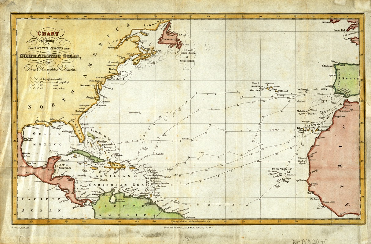
Chart shewing the tracks across the North Atlantic Ocean of Don Christopher Columbus
Chart shewing the tracks across the North Atlantic Ocean of Don Christopher Columbus
Item Information
Title:
Chart shewing the tracks across the North Atlantic Ocean of Don Christopher Columbus
Description:
Like many of the ancestors of today's Floridians, Christopher Columbus voyaged from his home in Europe across the North Atlantic to the West Indies. Sailing under the Spanish flag, he made four separate voyages departing from either Spain or Portugal. From his first voyage in 1492-93 to his final voyage in 1502-04, he visited many Caribbean islands, including the larger ones of Hispaniola, Cuba, and Jamaica, as well as the northern coast of South America. This map, published in Paris in 1828, reconstructs the approximate routes of Columbus' trans-Atlantic treks, indicating his location by month and day. The patterns established in these early voyages, which used the predominant ocean currents and the Trade Winds, are the general routes followed by many emigrants from the Iberian peninsula and Africa's West Coast to the Caribbean. It is their descendants who are now migrating to southern Florida.