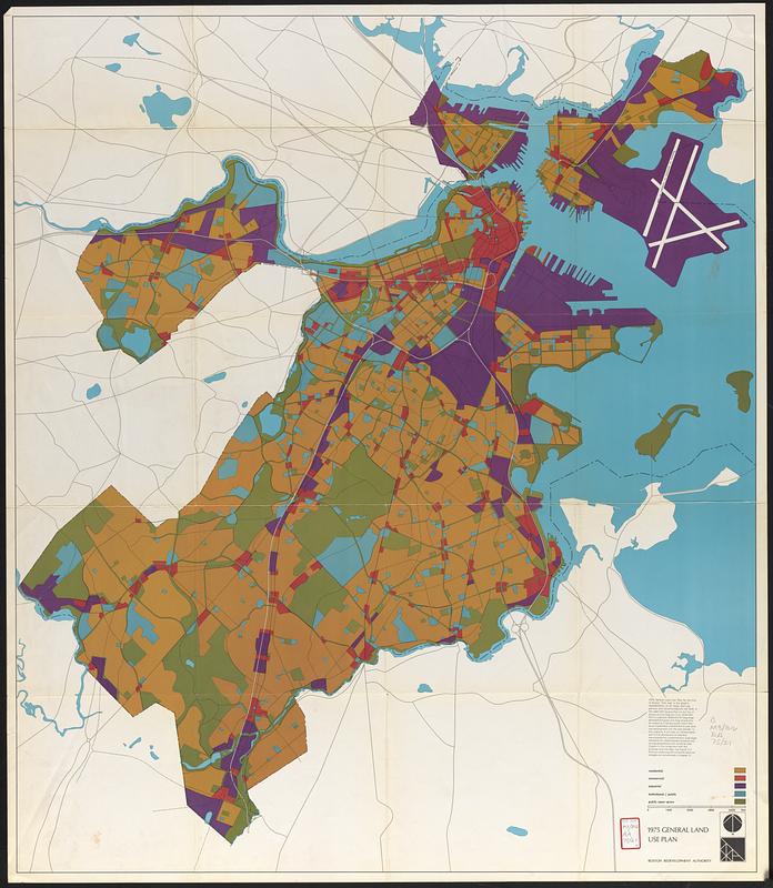
"Graphic representation of all major land use policies and recommendations set forth in the 1965/1975 general plan for the city of Boston and the regional core."
Indicates residential, commercial, industrial, institutional/public, and public open space.