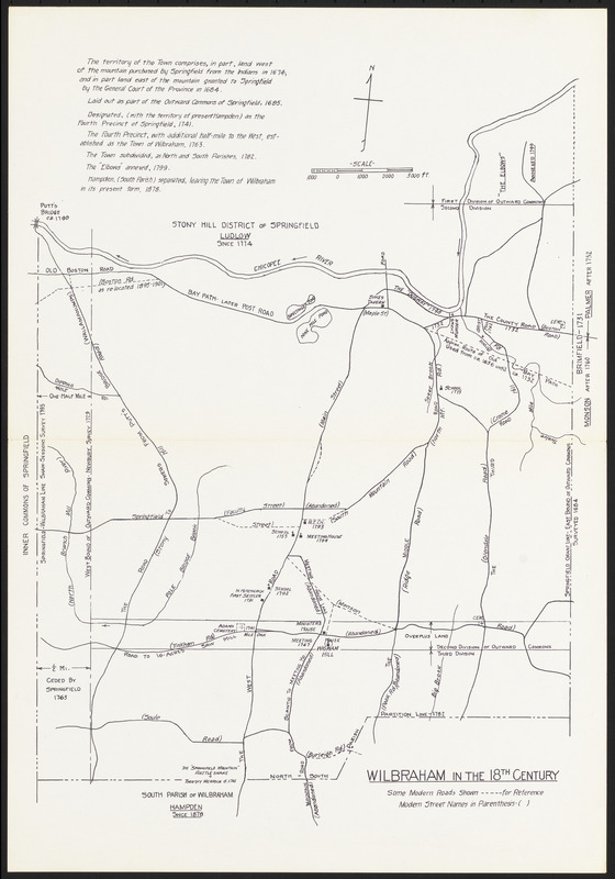
Wilbraham in the 18th century
Item Information
- Title:
- Wilbraham in the 18th century
- Date:
-
[ca. 1950–1960]
- Format:
-
Maps/Atlases
- Location:
- Wilbraham Public Library
- Collection (local):
-
Wilbraham Library Maps Collection
- Subjects:
-
1700–1799
- Places:
-
MassachusettsHampden (county)Wilbraham
- Extent:
- 1 map ; on sheet 38 x 26 cm
- Permalink:
- https://ark.digitalcommonwealth.org/ark:/50959/66830k05r
- Terms of Use:
-
No known copyright restrictions.
This work is licensed for use under a Creative Commons Attribution License (CC BY).

![A Perspective View of the Blockad[e] of Boston Harbour](https://bpldcassets.blob.core.windows.net/derivatives/metadata/commonwealth-oai:6q183z162/image_thumbnail_300.jpg)