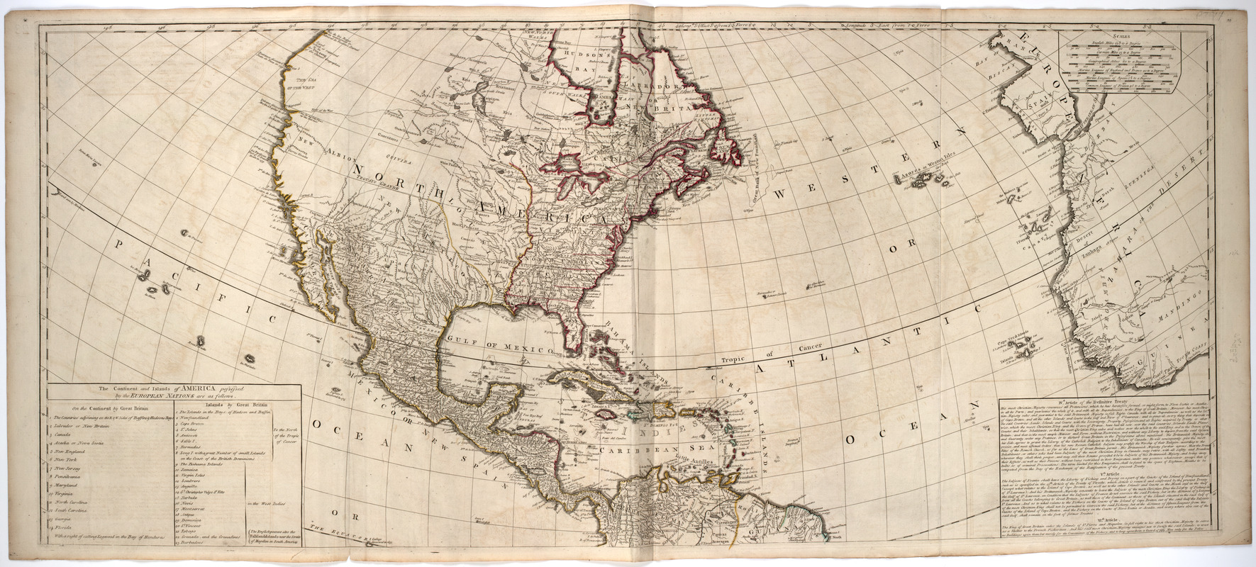
A New map of the whole continent of America, divided into North and South and West Indies. : Wherein are exactly described the United States of North America as well as the several European possessions according to the preliminaries of peace signed at Versailles Jan. 20, 1783
A New map of the whole continent of America, divided into North and South and West Indies. : Wherein are exactly described the United States of North America as well as the several European possessions according to the preliminaries of peace signed at Versailles Jan. 20, 1783
Description:
Subject: Map of the Western Hemisphere. Includes cartouche at bottom right with a native headpiece and quiver, a beaver and a crocodile or alligator, set in a landscape.
compiled from Mr. d'Anville's maps of that continent, with the addition of the Spanish discoveries in 1775 to the north of California & corrected in the several parts belonging to Great Britain from the original materials of Governor Pownall, M.P.
Prime meridian: Ferro.
Relief shown pictorially.
Inset: The supplement to North America containing the countries adjoining to Baffins & Hudsons bays.
"The continent and islands of America possessed by the European nations are as follows ... "