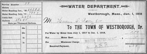
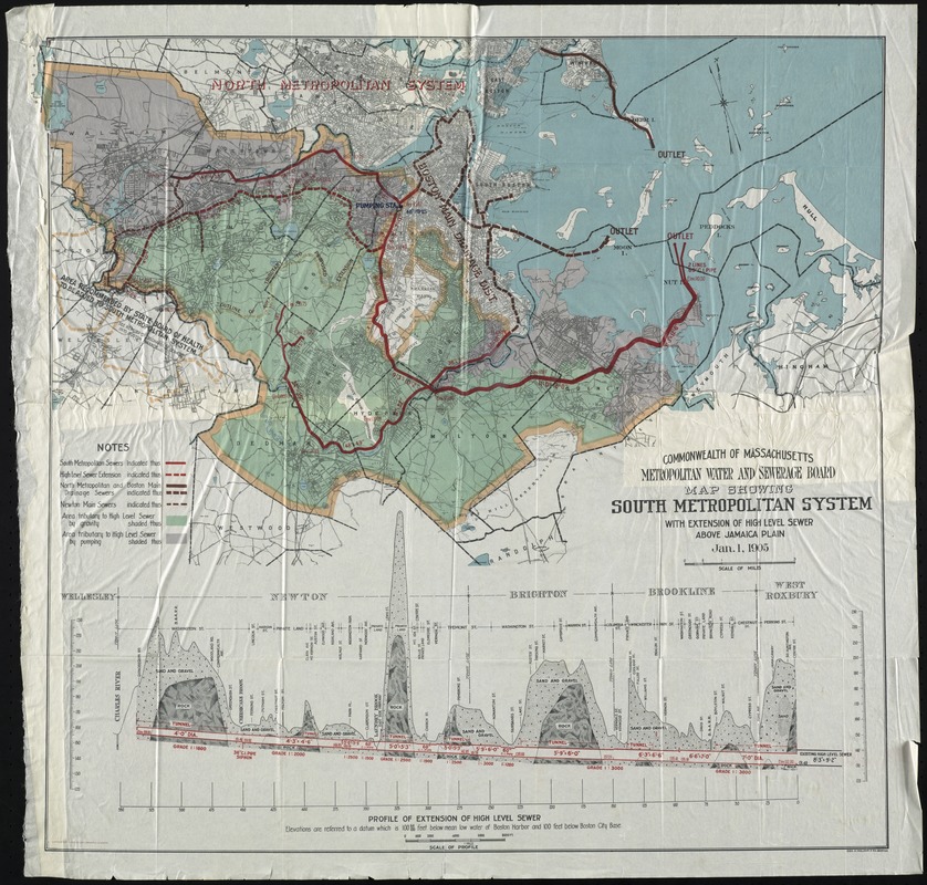
Metropolitan Water and Sewerage Board map showing South Metropolitan System with extension of high level sewer above Jamaica Plain.
Item Information
- Title:
- Metropolitan Water and Sewerage Board map showing South Metropolitan System with extension of high level sewer above Jamaica Plain.
- Name on Item:
-
Commonwealth of Massachusetts Metropolitan Water and Sewerage Board
- Date:
-
1905
- Format:
-
Maps/Atlases
- Location:
- Watertown Free Public Library
- Collection (local):
-
Watertown Free Public Library Local History Collection
- Subjects:
-
Sewerage
Water
Public utility companies
- Places:
-
Massachusetts
- Extent:
- 1 map : col. ; 74 x 74 cm
- Permalink:
- https://ark.digitalcommonwealth.org/ark:/50959/5m60r431n
- Terms of Use:
-
Rights status not evaluated.
This work is licensed for use under a Creative Commons Attribution Non-Commercial No Derivatives License (CC BY-NC-ND).