Skip to search
Skip to main content
Digital Commonwealth
Sign Up / Log In
Search for
Search
Search
Search
Basic
Advanced
Explore
Map
Collections
Institutions
Formats
For Educators
Primary Source Sets
Lesson Plans
Using Primary Sources
Searching Digital Commonwealth
For Institutions
How to Contribute Collections
Digitization Services
Frequently Asked Questions
Collection Development Policy
About
About Digital Commonwealth
News & Announcements
Copyright & Terms of Use
Harmful Content Statement
Accessibility Statement
Partners
API
Contact Us
Massachusetts Archives
Massachusetts Metropolitan District Water Supply Commission, Quabbin Reservoir, Photographs of Real Estate, Sanitary Conditions, and Flooding in the Ware River Watershed, and of General Engineering, 1928-1948
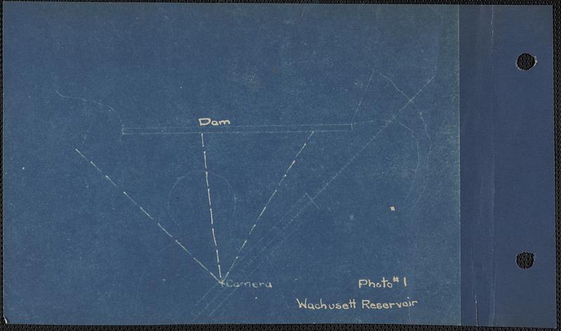
Sketch showing camera position and angle for landscape below Wachusett Dam from railroad trestle, Clinton, Mass., Sep. 15, 1929
×
Item Information
Title:
Sketch showing camera position and angle for landscape below Wachusett Dam from railroad trestle, Clinton, Mass., Sep. 15, 1929
Sponsor:
Massachusetts. Metropolitan District Water Supply Commission
Date:
September 15, 1929
Format:
Maps/Atlases
Genre:
Mechanical drawings
Location:
Massachusetts Archives
Collection (local):
Massachusetts. Executive Office of Energy and Environmental Affairs, Metropolitan District Water Supply Commission, Quabbin Reservoir, Photographs of Real Estate Takings
Subjects:
waterworks
reservoirs (water distribution structures)
fountains
Crataegus (genus)
dams (hydraulic structures)
Places:
Massachusetts
>
Worcester (county)
>
Wachusett Reservoir
Massachusetts
>
Worcester (county)
>
Clinton
Extent:
1 drawing : print ; sheet 12 x 17 cm (4.75 x 7 format)
Permalink:
https://ark.digitalcommonwealth.org/ark:/50959/5138n030n
Terms of Use:
No Copyright - United States
No known copyright restrictions.
No known restrictions on use.
Notes:
Title supplied by cataloger.
Blueprint sketch in album volume MDWSC, Wachusett Reservoir, for Print no. 1
See W-253 to W-256 inclusive
Notes (acquisition):
Massachusetts Metropolitan District Commission; Massachusetts Department of Conservation and Recreation
Accession #:
EN4.06/1335x.MDWSC.RealEstate.W0253.sketch.Wachusett.Reservoir
Identifier:
MDWSC_RE_W0253_sketch_Wachusett_Reservoir
show more...
View MODS XML
More Like This
Landscape below Wachusett Dam from railroad trestle, Clinton, ...
Landscape plan below dam from dam, Wachusett Reservoir, Clinton, ...
Sketch showing camera position and angle for landscape plan below ...
Tools
Share
Facebook
Pinterest
X
Reddit
Tumblr
Email
Copy link
Add to Folder
Questions/Comments
Cite This Item
IIIF Manifest
Downloads
Primary (full resolution, uncompressed)
(TIF, 28.6 MB)
Large (full resolution)
(JPEG, 2.4 MB)
Medium
(JPEG, 58.1 KB)