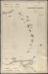
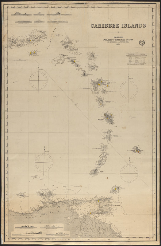
Skip to search
Skip to main content
Digital Commonwealth
Sign Up / Log In
Search for
Search
Search
Search
Basic
Advanced
Explore
Map
Collections
Institutions
Formats
For Educators
Primary Source Sets
Lesson Plans
Using Primary Sources
Searching Digital Commonwealth
For Institutions
Join Digital Commonwealth
Conferences, Trainings, & Events
How to Contribute Collections
Digitization Services
Board & Committees
Frequently Asked Questions
About
About Digital Commonwealth
News & Announcements
Copyright & Terms of Use
Harmful Content Statement
Partners
API
Contact Us
Atwood Museum of the Chatham Historical Society
Nautical Chart Collection of the Chatham Historical Society
Caribbee Islands
Caribbee Islands
×
Item Information
Title:
Caribbee Islands
Cartographer:
Imray, James F. (James Frederick), 1829?-1891
Name on Item:
Compiled by James F. Imray, F. R. G. S.
Date:
1871
Format:
Maps/Atlases
Genre:
Nautical charts
Location:
Atwood Museum of the Chatham Historical Society
Collection (local):
Nautical Chart Collection of the Atwood Museum, Chatham Historical Society
Subjects:
Islands
Places:
Lesser Antilles
(area)
Caribbean Sea
Extent:
1 map ; 101 x 65 cm
Permalink:
https://ark.digitalcommonwealth.org/ark:/50959/5138jp23v
Terms of Use:
No known copyright restrictions.
This work is licensed for use under a Creative Commons Attribution Non-Commercial No Derivatives License (CC BY-NC-ND).
Publisher:
London : James Imray & Son
Scale:
Scale 1:1,264,367
Notes:
Title from item.
Notes (date):
Date from item.
Identifier:
X.5500.033
show more...
View MODS XML
More Like This
The Caribbee Islands
From Muskeget Channel to Buzzard's Bay and entrance to Vineyard ...
The Great Bahama Bank
Java, blad I
Find More Like This >>
Tools
Share
Facebook
Pinterest
X
Reddit
Tumblr
Email
Copy link
Add to Folder
Questions/Comments
Cite This Item
Downloads
Primary (full resolution, uncompressed)
(TIF, 136 MB)
Large (full resolution)
(JPEG, 11.4 MB)
Medium
(JPEG, 141 KB)