Skip to search
Skip to main content
Digital Commonwealth
Sign Up / Log In
Search for
Search
Search
Search
Basic
Advanced
Explore
Map
Collections
Institutions
Formats
For Educators
Primary Source Sets
Lesson Plans
Using Primary Sources
Searching Digital Commonwealth
For Institutions
Join Digital Commonwealth
Conferences, Trainings, & Events
How to Contribute Collections
Digitization Services
Board & Committees
Frequently Asked Questions
About
About Digital Commonwealth
News & Announcements
Copyright & Terms of Use
Harmful Content Statement
Partners
API
Contact Us
Boston Public Library
Norman B. Leventhal Map Center Collection
/
Urban Maps (Collection of Distinction)
/
American Revolutionary War-Era Maps (Collection of Distinction)
/
Boston and New England Maps (Collection of Distinction)
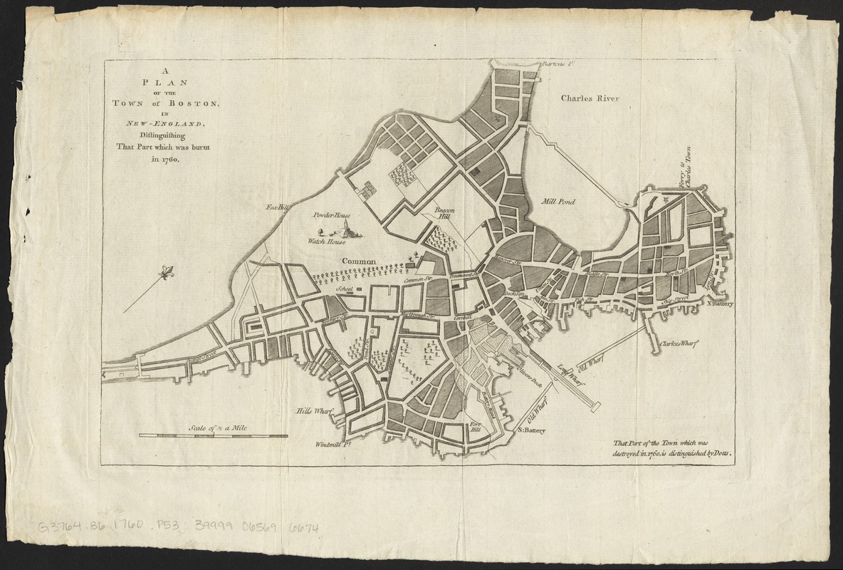
A plan of the town of Boston, in New-England, distinguishing that part which was burnt in 1760
A plan of the town of Boston, in New-England, distinguishing that part which was burnt in 1760
×
Item Information
Title:
A plan of the town of Boston, in New-England, distinguishing that part which was burnt in 1760
Title (uniform):
Royal female magazine
Description:
Plan of the city of Boston, showing the part of the city near the Old Wharf that was destroyed by fire. Street names are labeled.
Date:
1760
Format:
Maps/Atlases
Location:
Boston Public Library
Norman B. Leventhal Map Center
Collection (local):
Norman B. Leventhal Map Center Collection
Subjects:
Fires--Massachusetts--Boston--Maps
Boston (Mass.)--Maps
Places:
Suffolk (county)
>
Boston
Extent:
1 map ; 19 x 29 cm
Permalink:
https://ark.digitalcommonwealth.org/ark:/50959/4m90fn35k
Terms of Use:
No known copyright restrictions.
No known restrictions on use.
Publisher:
[London] : [Royal female magazine]
Scale:
Scale approximately 1:12,000
Language:
English
Notes:
Oriented with north to the upper right.
From the Royal female magazine, London, approximately 1760.
Identifier:
06_01_012248
Call #:
G3764.B6 1760 .P53
Barcode:
39999065696674
show more...
View MODS XML
More Like This
A Plan of the town of Boston, in New-England, : distinguishing ...
Annexation map
Atlas of the city of Boston : Boston proper : from actual surveys ...
Atlas of the city of Boston : Boston proper and Back Bay : from ...
Find More Like This >>
Tools
Share
Facebook
Pinterest
X
Reddit
Tumblr
Email
Copy link
Add to Folder
Questions/Comments
Cite This Item
IIIF Manifest
Downloads
Primary (full resolution, uncompressed)
(TIF, 155 MB)
Large (full resolution)
(JPEG, 13 MB)
Medium
(JPEG, 286 KB)