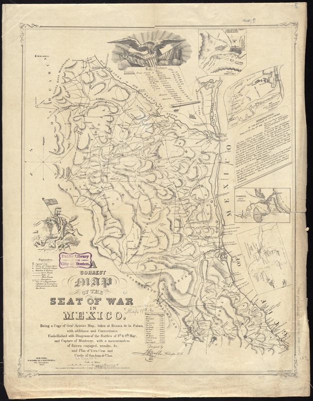
A correct map of the seat of war in Mexico : being a copy of Genl. Arista's map, taken at Resaca de la Palma, with additions and corrections ; embellished with diagrams of the battles of 8th and 9th May, and capture of Monterey, with a memorandum of forces engaged, results, &c. and plan of Vera Cruz and castle of San Juan de Ulua
A correct map of the seat of war in Mexico
Item Information
Title:
A correct map of the seat of war in Mexico : being a copy of Genl. Arista's map, taken at Resaca de la Palma, with additions and corrections ; embellished with diagrams of the battles of 8th and 9th May, and capture of Monterey, with a memorandum of forces engaged, results, &c. and plan of Vera Cruz and castle of San Juan de Ulua
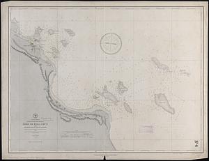
Relief shown by hachures. Depths shown by soundings.
Shows portion of Mexico involved in the Battle of Monterrey with historical notes; cities, roads, rivers, and troop movement.
Includes 2 illustrations: American eagle at head of "Table of Distances," and cavalryman with United States flag; text: "Memorandum of the Battles of 8th & 9th May;" legend: "Explanation" of symbols used; and table of "Heights of Towns & Mountains."
"Entered according to Act of Congress, in the Year 1847, by J.G. Bruff, in the Clerk's Office of the Distt. Court of the Southern Distt. of New York."
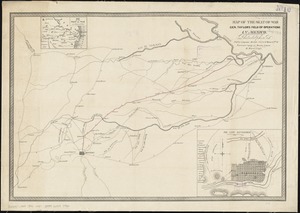
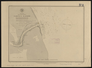
Insets: Plan of Monterey -- Map showing the battle grounds of the 8th and 9th May 1846 -- Tampico and its environs -- Chart of the Bay of Vera Cruz.