Trans-continental map : showing the main lines and proposed extensions of the various trans-continental railroad systems of the Unites States and Canada, and some of the important connecting lines
Trans-continental map
Item Information
Title:
Trans-continental map : showing the main lines and proposed extensions of the various trans-continental railroad systems of the Unites States and Canada, and some of the important connecting lines
Description:
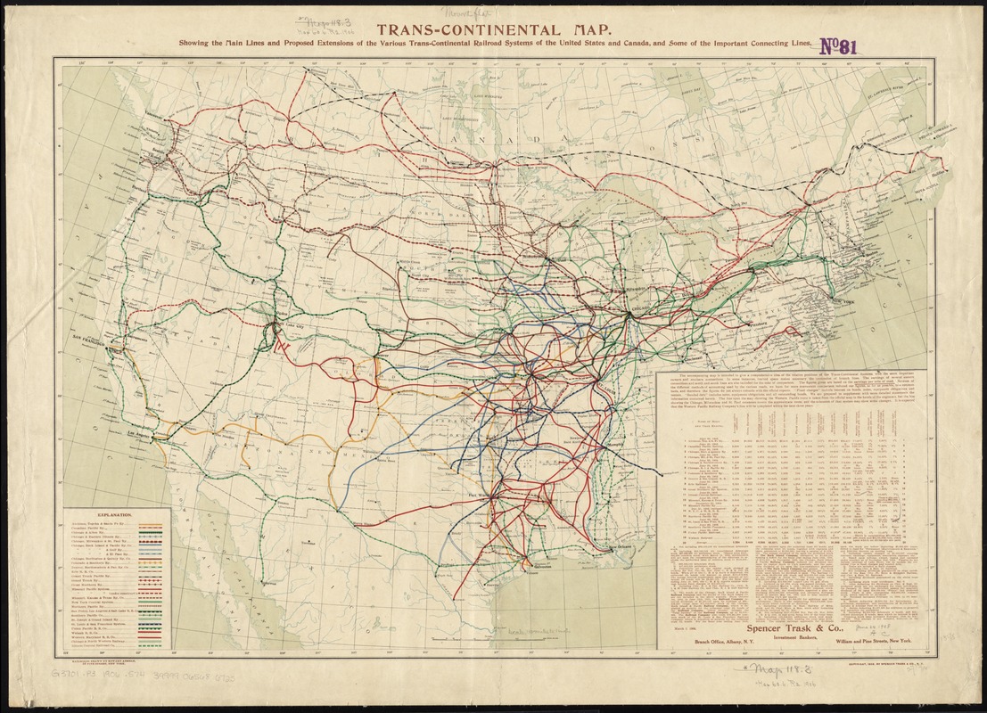
America Transformed: At the end of the century, the nation's railroad network grew rapidly, resulting in a complex web that linked the eastern and western parts of the country. This map, prepared by a New York investment banker, represents the locations of the transcontinental systems and their connections to eastern and southern railroads. The legend identifies routes for 29 companies. The map highlights the impressive complexity of the rail lines in the central United States. The major cities in this region were centers of railroad traffic. Chicago had the largest number of connections with at least 10 lines converging on the city.
Exhibited: "America Transformed. Part 2: Homesteads to Modern Cities," organized by the Norman B. Leventhal Map & Education Center at the Boston Public Library, 2019-2020.