Skip to search
Skip to main content
Digital Commonwealth
Sign Up / Log In
Search for
Search
Search
Search
Basic
Advanced
Explore
Map
Collections
Institutions
Formats
For Educators
Primary Source Sets
Lesson Plans
Using Primary Sources
Searching Digital Commonwealth
For Institutions
Join Digital Commonwealth
Conferences, Trainings, & Events
How to Contribute Collections
Digitization Services
Board & Committees
Frequently Asked Questions
About
About Digital Commonwealth
News & Announcements
Copyright & Terms of Use
Harmful Content Statement
Partners
API
Contact Us
Boston Public Library
Norman B. Leventhal Map Center Collection
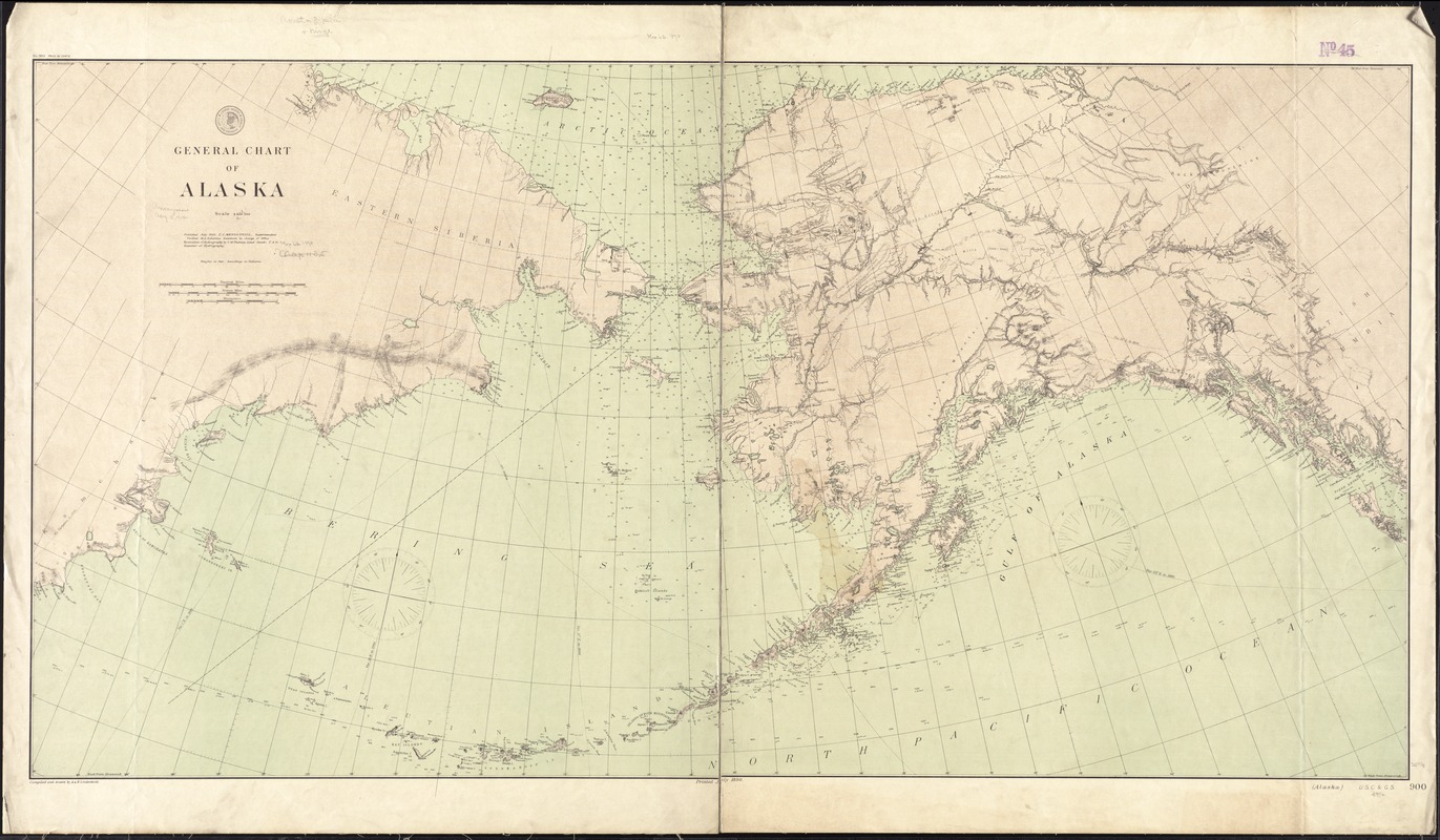
General chart of Alaska
General chart of Alaska
×
Item Information
Title:
General chart of Alaska
Title in lower right margin :
Alaska
Creator:
U.S. Coast and Geodetic Survey
Name on Item:
compiled and drawn by A. & H. Lindenkohl.
Date:
1890
Format:
Maps/Atlases
Location:
Boston Public Library
Norman B. Leventhal Map Center
Collection (local):
Norman B. Leventhal Map Center Collection
Subjects:
Alaska--Maps
Places:
Alaska
Extent:
1 map : col. ; 66 x 127 cm.
Permalink:
https://ark.digitalcommonwealth.org/ark:/50959/4m90fb94w
Terms of Use:
No known copyright restrictions.
No known restrictions on use.
Publisher:
Washington, D.C : U.S. Coast and Geodetic Survey
Scale:
Scale [1:3,6000,000]
Language:
English
Notes:
Relief shown by hachures and spot heights. Depths shown by isolines and soundings.
"No. 900."
Identifier:
06_01_011374
Call #:
G4370 1890 .U83
Barcode:
39999065684506
show more...
View MODS XML
More Like This
Alaska and adjoining region
Alaska and adjoining territory
Alaska and adjoining territory
The Alaska Railroad
Find More Like This >>
Tools
Share
Facebook
Pinterest
X
Reddit
Tumblr
Email
Copy link
Add to Folder
Questions/Comments
Cite This Item
IIIF Manifest
Downloads
Primary (full resolution, uncompressed)
(TIF, 95.9 MB)
Large (full resolution)
(JPEG, 8.05 MB)
Medium
(JPEG, 339 KB)