Skip to search
Skip to main content
Digital Commonwealth
Sign Up / Log In
Search for
Search
Search
Search
Basic
Advanced
Explore
Map
Collections
Institutions
Formats
For Educators
Primary Source Sets
Lesson Plans
Using Primary Sources
Searching Digital Commonwealth
For Institutions
Join Digital Commonwealth
Conferences, Trainings, & Events
How to Contribute Collections
Digitization Services
Board & Committees
Frequently Asked Questions
About
About Digital Commonwealth
News & Announcements
Copyright & Terms of Use
Harmful Content Statement
Partners
API
Contact Us
Boston Public Library
Norman B. Leventhal Map Center Collection
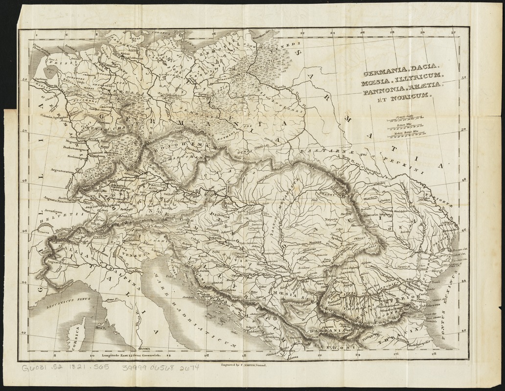
Germania, Dacia, Mœsia, Illyricum, Pannonia, Rhætia, et Noricum
Germania, Dacia, Mœsia, Illyricum, Pannonia, Rhætia, et Noricum
×
Item Information
Title:
Germania, Dacia, Mœsia, Illyricum, Pannonia, Rhætia, et Noricum
Creator:
Smith, Charles, active 1799-1852
Name on Item:
engraved by C. Smith.
Date:
[1821]
Format:
Maps/Atlases
Location:
Boston Public Library
Norman B. Leventhal Map Center
Collection (local):
Norman B. Leventhal Map Center Collection
Subjects:
Europe, Central--Antiquities--Maps
Balkan Peninsula--Antiquities--Maps
Dacia--Maps
Illyria--Maps
Moesia--Maps
Noricum--Maps
Pannonia--Maps
Raetia--Maps
Places:
Central Europe
(area)
Balkan Peninsula
(area)
Dacia
(area)
Illyria
(area)
Noricum
(province)
Pannonia
(area)
Raetia
(area)
Moesia
(province)
Extent:
1 map ; 26 x 34 cm.
Permalink:
https://ark.digitalcommonwealth.org/ark:/50959/4m90f8448
Terms of Use:
No known copyright restrictions.
No known restrictions on use.
Publisher:
[London] : [Printed by J.F. Dove ... for Priestley and Weale]
Scale:
Scale [ca. 1:14,500,000]
Language:
English
Notes:
Relief shown by hachures.
Likely from Nathaniel Hooke's The Roman history, from the building of Rome to the ruin of the commonwealth ... London: Printed by J.F. Dove ... for Priestley and Weale, 1821. Vol. 6.
Notes (date):
This date is inferred.
Identifier:
06_01_011183
Call #:
G6031.S2 1821 .S65
Barcode:
39999065682674
show more...
View MODS XML
More Like This
The 100th anniversary map of Abraham Lincoln's visit to ...
1630 shoreline
1879. Progress map of the U.S. Geographical Surveys west of the ...
1903 Map of Salem and surrounding places
Find More Like This >>
Tools
Share
Facebook
Pinterest
X
Reddit
Tumblr
Email
Copy link
Add to Folder
Questions/Comments
Cite This Item
IIIF Manifest
Downloads
Primary (full resolution, uncompressed)
(TIF, 185 MB)
Large (full resolution)
(JPEG, 15.5 MB)
Medium
(JPEG, 359 KB)