Skip to search
Skip to main content
Digital Commonwealth
Sign Up / Log In
Search for
Search
Search
Search
Basic
Advanced
Explore
Map
Collections
Institutions
Formats
For Educators
Primary Source Sets
Lesson Plans
Using Primary Sources
Searching Digital Commonwealth
For Institutions
Join Digital Commonwealth
Conferences, Trainings, & Events
How to Contribute Collections
Digitization Services
Board & Committees
Frequently Asked Questions
About
About Digital Commonwealth
News & Announcements
Copyright & Terms of Use
Harmful Content Statement
Partners
API
Contact Us
Boston Public Library
Norman B. Leventhal Map Center Collection
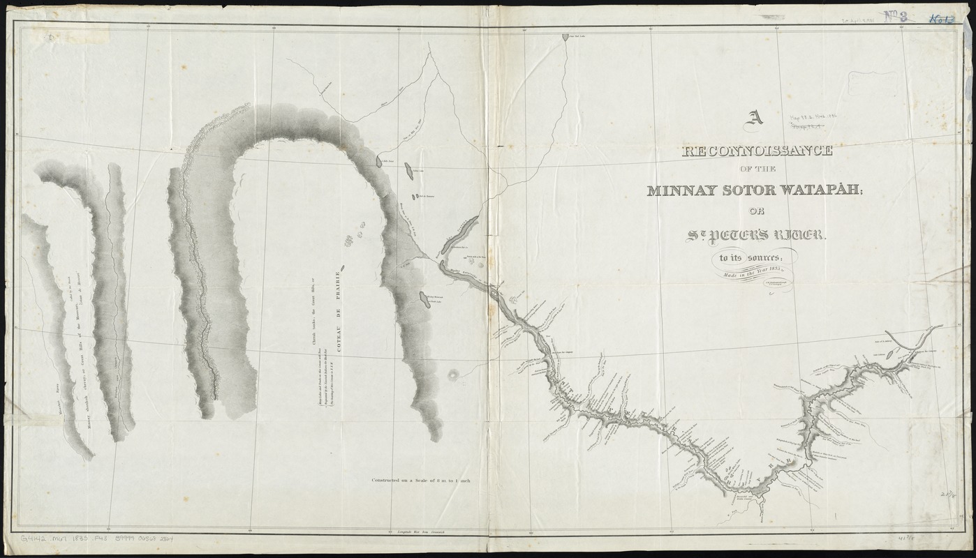
A reconnoissance of the Minnay Sotor Watapāh; or St. Peter's River to its sources : made in the year 1835
A reconnoissance of the Minnay Sotor Watapāh; or St. Peters River to its sources
×
Item Information
Title:
A reconnoissance of the Minnay Sotor Watapāh; or St. Peter's River to its sources : made in the year 1835
Creator:
Featherstonhaugh, George William, 1780-1866
Name on Item:
by G.W. Featherstonhaugh, U.S. geologist.
Date:
[1835]
Format:
Maps/Atlases
Location:
Boston Public Library
Norman B. Leventhal Map Center
Collection (local):
Norman B. Leventhal Map Center Collection
Subjects:
Minnesota River (S.D. and Minn.)--Maps
Places:
Minnesota
(river)
Extent:
1 map ; 56 x 106 cm.
Permalink:
https://ark.digitalcommonwealth.org/ark:/50959/4m90f8163
Terms of Use:
No known copyright restrictions.
No known restrictions on use.
Publisher:
S.l : s.n.
Scale:
Scale [1:506,880]. 8 m. to 1 in.
Language:
English
Notes:
Relief shown by hachures.
Shows points of interest and topography.
Includes Indian and French terms.
Also shows part of Minnay shoshoh chrray; or Great Hills of the Missouri, called by the French "Coteau de Missouri."
Notes (date):
This date is inferred.
Identifier:
06_01_011169
Call #:
G4142.M67 1835 .F43
Barcode:
39999065682864
LCCN:
gm 71005607
show more...
View MODS XML
More Like This
The 100th anniversary map of Abraham Lincoln's visit to ...
1630 shoreline
1879. Progress map of the U.S. Geographical Surveys west of the ...
1903 Map of Salem and surrounding places
Find More Like This >>
Tools
Share
Facebook
Pinterest
X
Reddit
Tumblr
Email
Copy link
Add to Folder
Questions/Comments
Cite This Item
IIIF Manifest
Downloads
Primary (full resolution, uncompressed)
(TIF, 305 MB)
Large (full resolution)
(JPEG, 25.6 MB)
Medium
(JPEG, 246 KB)