Skip to search
Skip to main content
Digital Commonwealth
Sign Up / Log In
Search for
Search
Search
Search
Basic
Advanced
Explore
Map
Collections
Institutions
Formats
For Educators
Primary Source Sets
Lesson Plans
Using Primary Sources
Searching Digital Commonwealth
For Institutions
Join Digital Commonwealth
Conferences, Trainings, & Events
How to Contribute Collections
Digitization Services
Board & Committees
Frequently Asked Questions
About
About Digital Commonwealth
News & Announcements
Copyright & Terms of Use
Harmful Content Statement
Partners
API
Contact Us
Boston Public Library
Norman B. Leventhal Map Center Collection
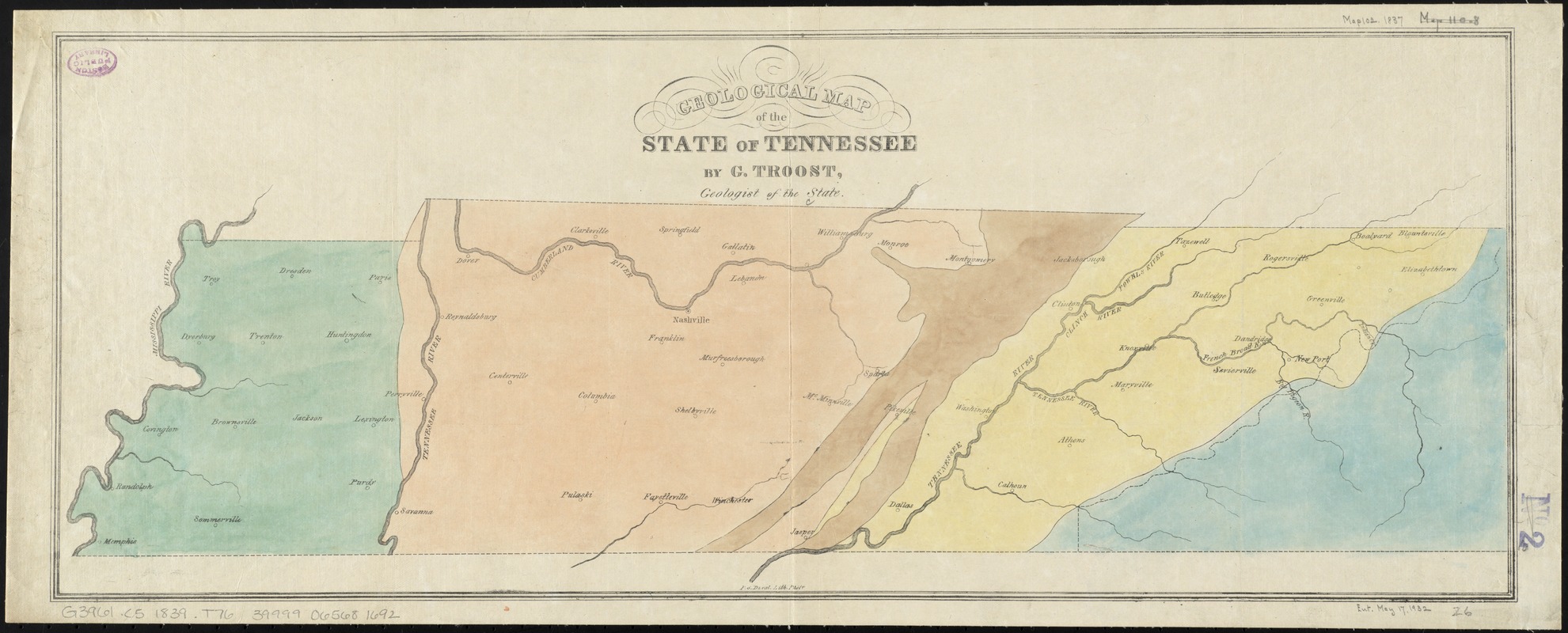
Geological map of the state of Tennessee
Geological map of the state of Tennessee
×
Item Information
Title:
Geological map of the state of Tennessee
Creator:
Troost, Gerard, 1776-1850
Name on Item:
by G. Troost ; P.S. Duval lith.
Date:
[1839]
Format:
Maps/Atlases
Location:
Boston Public Library
Norman B. Leventhal Map Center
Collection (local):
Norman B. Leventhal Map Center Collection
Subjects:
Geology--Tennessee--Maps
Tennessee--Maps
Places:
Tennessee
Extent:
1 map : color ; 26 x 67 cm
Permalink:
https://ark.digitalcommonwealth.org/ark:/50959/4m90f6721
Terms of Use:
No known copyright restrictions.
No known restrictions on use.
Publisher:
Tennessee : s.n.
Scale:
Scale [ca. 1:1,100,000]
Language:
English
Notes:
Shows main rivers and tributaries, towns and cities.
Does not include reference for colors.
From: Fifth report of Dr. G. Troost, State Geologist.
Notes (date):
This date is inferred.
Identifier:
06_01_011068
Call #:
G3961.C5 1839 .T76
Barcode:
39999065681692
show more...
View MODS XML
More Like This
Geological map of Tennessee
Kentucky and Tennessee
Kentucky and Tennessee
Map of Kentucky and Tennessee
Find More Like This >>
Tools
Share
Facebook
Pinterest
X
Reddit
Tumblr
Email
Copy link
Add to Folder
Questions/Comments
Cite This Item
IIIF Manifest
Downloads
Primary (full resolution, uncompressed)
(TIF, 69 MB)
Large (full resolution)
(JPEG, 5.79 MB)
Medium
(JPEG, 379 KB)