Map of Boston : showing health districts and undrained and filled land
Map of Boston
Item Information
Title:
Map of Boston : showing health districts and undrained and filled land
Description:
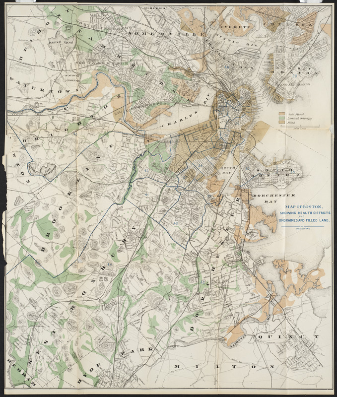
In 1874, the State Board of Health of Massachusetts divided the Commonwealth into “health districts,” areas assigned to physicians tasked with documenting the locations of prevalent diseases. This map denotes these health districts, along with the polluted marshlands and low-lying ground believed to spread diseases such as consumption, cholera, and malaria. If dark, damp, low land promoted illness, health reformers thought, then the opposite must hold true. In the years to come, Bostonians would increasingly seek out “breathing-places”: well-lit, dry, green spaces, where they might take in the fresh air for their health.