Skip to search
Skip to main content
Digital Commonwealth
Sign Up / Log In
Search for
Search
Search
Search
Basic
Advanced
Explore
Map
Collections
Institutions
Formats
For Educators
Primary Source Sets
Lesson Plans
Using Primary Sources
Searching Digital Commonwealth
For Institutions
Join Digital Commonwealth
Conferences, Trainings, & Events
How to Contribute Collections
Digitization Services
Board & Committees
Frequently Asked Questions
About
About Digital Commonwealth
News & Announcements
Copyright & Terms of Use
Harmful Content Statement
Partners
API
Contact Us
Boston Public Library
Norman B. Leventhal Map Center Collection
/
American Revolutionary War-Era Maps (Collection of Distinction)
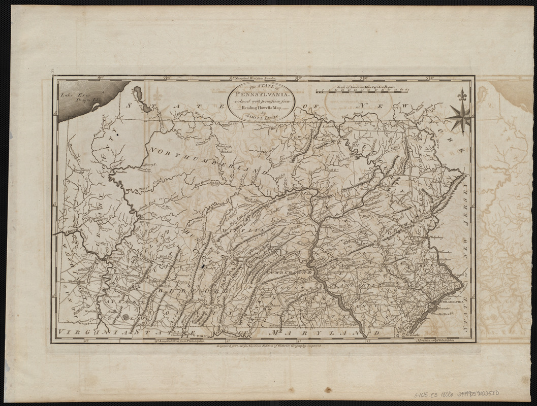
The state of Pennsylvania : reduced with permission from Reading Howells map
The state of Pennsylvania
×
Item Information
Title:
The state of Pennsylvania : reduced with permission from Reading Howells map
Creator:
Lewis, Samuel, 1753 or 4-1822
Cartographer:
Lewis, Samuel, 1753 or 4-1822
Contributor:
Howell, Reading, 1743-1827
Engraver:
Smither, James, 1741-1797
Publisher:
Carey, Mathew, 1760-1839
Name on Item:
by Samuel Lewis ; Smither sculp.
Date:
[1800]
Format:
Maps/Atlases
Location:
Boston Public Library
Norman B. Leventhal Map Center
Collection (local):
Norman B. Leventhal Map Center Collection
Subjects:
Pennsylvania--Maps
Places:
Pennsylvania
Extent:
1 map ; 28 x 45 cm
Permalink:
https://ark.digitalcommonwealth.org/ark:/50959/3f463008z
Terms of Use:
No known copyright restrictions.
No known restrictions on use.
Publisher:
[Philadelphia] : [Mathew Carey]
Scale:
Scale approximately 1:1,130,000
Language:
English
Notes:
Relief shown pictorially.
Prime meridians: Philadelphia and London.
"Engraved for Carey's American edition of Guthrie's Geography improved."
In upper left margin: 33.
Map 33 in his Carey's general atlas. Philadelphia : Mathew Carey, 1800.
Notes (date):
This date is inferred.
Identifier:
06_01_004552
Call #:
G1015 .C3 1800x
Barcode:
30000005056562
show more...
View MODS XML
More Like This
Clemens' map of Pennsylvania
Geological and topographical map of the anthracite fields of ...
Geological map of south-west Pennsylvania, with special reference ...
Grundriss von Philadelphia der hauptstadt in Pensylvanien und ...
Find More Like This >>
Tools
Share
Facebook
Pinterest
X
Reddit
Tumblr
Email
Copy link
Add to Folder
Questions/Comments
Cite This Item
IIIF Manifest
Downloads
Primary (full resolution, uncompressed)
(TIF, 56.7 MB)
Large (full resolution)
(JPEG, 4.76 MB)
Medium
(JPEG, 364 KB)