Skip to search
Skip to main content
Digital Commonwealth
Sign Up / Log In
Search for
Search
Search
Search
Basic
Advanced
Explore
Map
Collections
Institutions
Formats
For Educators
Primary Source Sets
Lesson Plans
Using Primary Sources
Searching Digital Commonwealth
For Institutions
Join Digital Commonwealth
Conferences, Trainings, & Events
How to Contribute Collections
Digitization Services
Board & Committees
Frequently Asked Questions
About
About Digital Commonwealth
News & Announcements
Copyright & Terms of Use
Harmful Content Statement
Partners
API
Contact Us
Boston Public Library
Norman B. Leventhal Map Center Collection
/
American Revolutionary War-Era Maps (Collection of Distinction)
/
Maritime Charts and Atlases (Collection of Distinction)
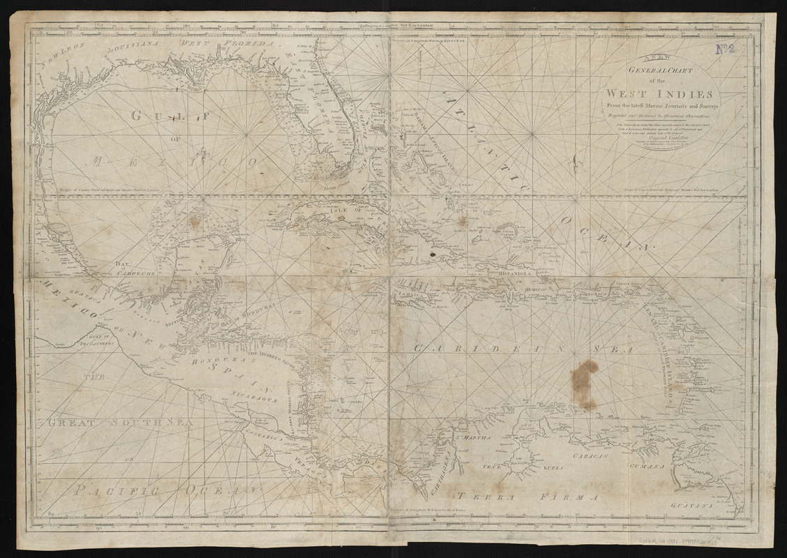
A new general chart of the West Indies from the latest marine journals and srveys regulated and ascertained by astronomical observations
A new general chart of the West Indies from the latest marine journals and srveys regulated and ascertained by astronomical observations
×
Item Information
Title:
A new general chart of the West Indies from the latest marine journals and srveys regulated and ascertained by astronomical observations
Creator:
Norman, John, 1748?-1817
Cartographer:
Norman, John, 1748?-1817
Publisher:
Norman, William, -1807
Date:
[1798]
Format:
Maps/Atlases
Location:
Boston Public Library
Norman B. Leventhal Map Center
Collection (local):
Norman B. Leventhal Map Center Collection
Subjects:
Coasts--Central America--Maps--Early works to 1800
Coasts--Southern States--Maps--Early works to 1800
Nautical charts--West Indies--Maps--Early works to 1800
West Indies--Maps--Early works to 1800
Places:
Mesoamerica
(area)
Southern United States
(area)
West Indies
Extent:
1 map ; 65 x 96 cm
Permalink:
https://ark.digitalcommonwealth.org/ark:/50959/3f462z435
Terms of Use:
No known copyright restrictions.
No known restrictions on use.
Publisher:
[Boston] : W. Norman
Scale:
Scale approximately 1:4,150,000
Language:
English
Notes:
Depths shown by soundings.
Prime meridians: London, Kingston and Ferro.
Includes certification of accuracy from Osgood Carleton.
In Norman's The American pilot. Boston : William Norman, 1798.
Notes (date):
This date is inferred.
Identifier:
06_01_004839
Call #:
G1106.P5 N6 1798x
Barcode:
30000005069237
show more...
View MODS XML
More Like This
A new general chart of the West Indies from the latest marine ...
A new general chart of the West Indies from the latest marine ...
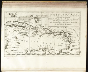
Isole Antili, la Cuba, la Spagnuola
Carta particolare della Baia di Messico con la costa
Find More Like This >>
Tools
Share
Facebook
Pinterest
X
Reddit
Tumblr
Email
Copy link
Add to Folder
Questions/Comments
Cite This Item
IIIF Manifest
Downloads
Primary (full resolution, uncompressed)
(TIF, 179 MB)
Large (full resolution)
(JPEG, 15.1 MB)
Medium
(JPEG, 371 KB)