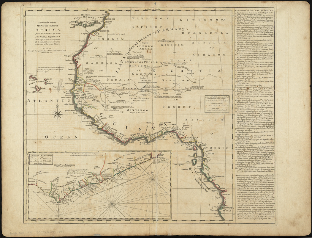
A new and correct map of the coast of Africa, from Sta. Cruz lat. 30 north. to the coast of Angola lat 11. S. with explanatory notes of all the forts and settlements belonging to the several European powers
A new and correct map of the coast of Africa, from Sta. Cruz lat. 30 north. to the coast of Angola lat 11. S. with explanatory notes of all the forts and settlements belonging to the several European powers
Item Information
Title:
A new and correct map of the coast of Africa, from Sta. Cruz lat. 30 north. to the coast of Angola lat 11. S. with explanatory notes of all the forts and settlements belonging to the several European powers
Description:
We Are One: This map illustrates the intersection of native African and European cultures in western Africa during the mid-18th century. Besides designating which native kingdoms ruled the coastal regions, it also locates European settlements, forts, and trading sites along the coast. The inset map and marginal legend identify individual ports by nationality. These European footholds were used in the slave trade and to export natural resources like gold.
Boston Public Library copy removed from Bowles' A general atlas of thirty-six new and correct maps. [London : Carington Bowles, 1771?].
Relief shown pictorially.
Inset: A correct chart of the Gold Coast according to the Sr. Danville.
Includes text.
This map can be viewed as a georeferenced overlay in an interactive application made especially for We Are One: Mapping America's Road from Revolution to Independence http://d2o8owo4k087al.cloudfront.net/index.html?mapId=29.
Notes (exhibitions):
Exhibited: "We Are One: Mapping America's Road from Revolution to Independence" organized by the Norman B. Leventhal Map Center at the Boston Public Library, 2015.