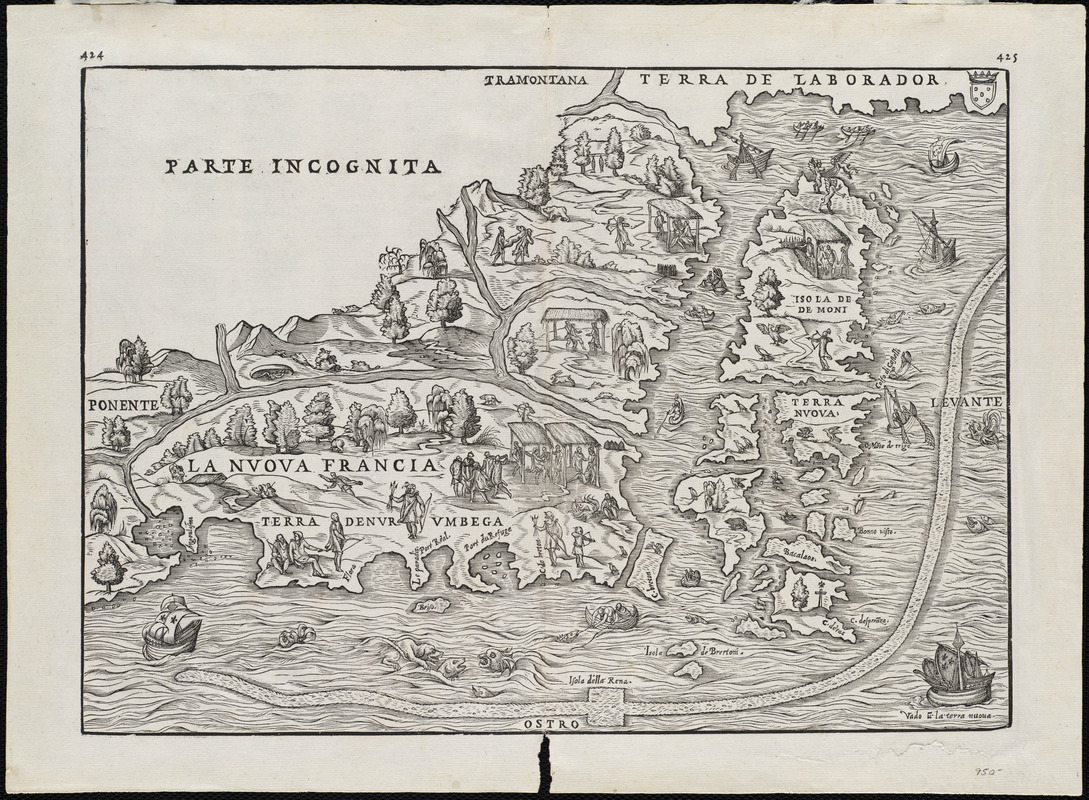
La Nuoua Francia
Item Information
- Title:
- La Nuoua Francia
- Title (alt.):
-
Nvova Francia
Nuova Francia
- Description:
-
This map, among the earliest separate maps of northeastern North America, was primarily based on the voyages that were taken by Giovanni da Verrazano for the French in 1524. His discoveries confirmed the continuous nature of the American coast from the Carolinas to Newfoundland. The New England region was named Terra de Nurumbega, as well as New France after the country which sponsored Verrazano's expedition. During his travels, he spent two weeks with friendly Indians at Narragansett Bay, which is identified as Port du Refuge on the map. Giovanni Battista Ramusio was a Venetian historian and geographer. His book was one of the earliest compilations of voyages of discovery.
- Creator:
- Ramusio, Giovanni Battista, 1485-1557
- Date:
-
[1565]
- Format:
-
Maps/Atlases
- Location:
-
Private Collection
Norman B. Leventhal Map Center - Collection (local):
-
Mapping Boston Collection
- Subjects:
-
New France--Maps--Early works to 1800
North America--Maps--Early works to 1800
- Places:
-
New France
- Extent:
- 1 map ; 27 x 37 cm.
- Permalink:
- https://ark.digitalcommonwealth.org/ark:/50959/3f462s345
- Terms of Use:
-
No known copyright restrictions.
This work is licensed for use under a Creative Commons Attribution Non-Commercial Share Alike License (CC BY-NC-SA).


Downloads