Skip to search
Skip to main content
Digital Commonwealth
Sign Up / Log In
Search for
Search
Search
Search
Basic
Advanced
Explore
Map
Collections
Institutions
Formats
For Educators
Primary Source Sets
Lesson Plans
Using Primary Sources
Searching Digital Commonwealth
For Institutions
Join Digital Commonwealth
Conferences, Trainings, & Events
How to Contribute Collections
Digitization Services
Board & Committees
Frequently Asked Questions
About
About Digital Commonwealth
News & Announcements
Copyright & Terms of Use
Harmful Content Statement
Partners
API
Contact Us
Boston Public Library
Norman B. Leventhal Map Center Collection
/
Urban Maps (Collection of Distinction)
/
Boston and New England Maps (Collection of Distinction)
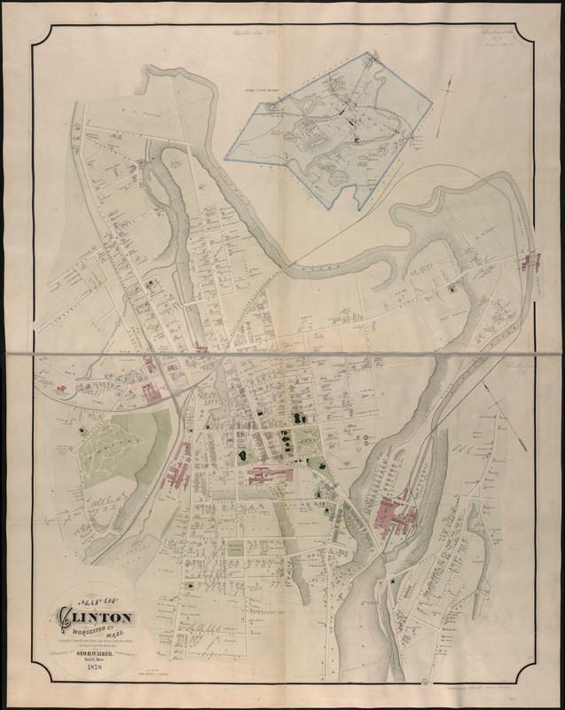
Map of Clinton Worcester Co. Mass
Map of Clinton Worcester Co. Mass
×
Item Information
Title:
Map of Clinton Worcester Co. Mass
Creator:
Geo. H. Walker & Co
Name on Item:
compiled from private plans and actual surveys under the direction of the publisher.
Date:
1878
Format:
Maps/Atlases
Location:
Boston Public Library
Norman B. Leventhal Map Center
Collection (local):
Norman B. Leventhal Map Center Collection
Subjects:
Real property--Massachusetts--Clinton--Maps
Landowners--Massachusetts--Clinton--Maps
Clinton (Mass.)--Maps
Places:
Worcester (county)
>
Clinton
Extent:
1 map on 2 sheets : col. ; 130 x 100 cm, sheets 66 x 100 cm.
Permalink:
https://ark.digitalcommonwealth.org/ark:/50959/1257bc892
Terms of Use:
No known copyright restrictions.
No known restrictions on use.
Publisher:
Boston, Mass : Geo. H. Walker & Co.
Scale:
Scale 1:2,400.
Language:
English
Notes:
Oriented with north toward the upper left.
Relief shown by hachures.
Includes inset of the town on a larger scale.
Identifier:
06_01_005318
Call #:
G3764.C6G46 1878 .W3x
Barcode:
39999059015063
show more...
View MODS XML
More Like This
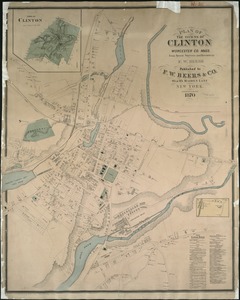
Plan of the towns of Clinton, Worcester Co. Mass : from recent ...
Plan of Nashua River from Lancaster Mills to S. Harris
Atlas of the boundaries of the city of Marlborough and towns of ...
The 100th anniversary map of Abraham Lincoln's visit to ...
Find More Like This >>
Tools
Share
Facebook
Pinterest
X
Reddit
Tumblr
Email
Copy link
Add to Folder
Questions/Comments
Cite This Item
IIIF Manifest
Downloads
Primary (full resolution, uncompressed)
(TIF, 298 MB)
Large (full resolution)
(JPEG, 25 MB)
Medium
(JPEG, 164 KB)