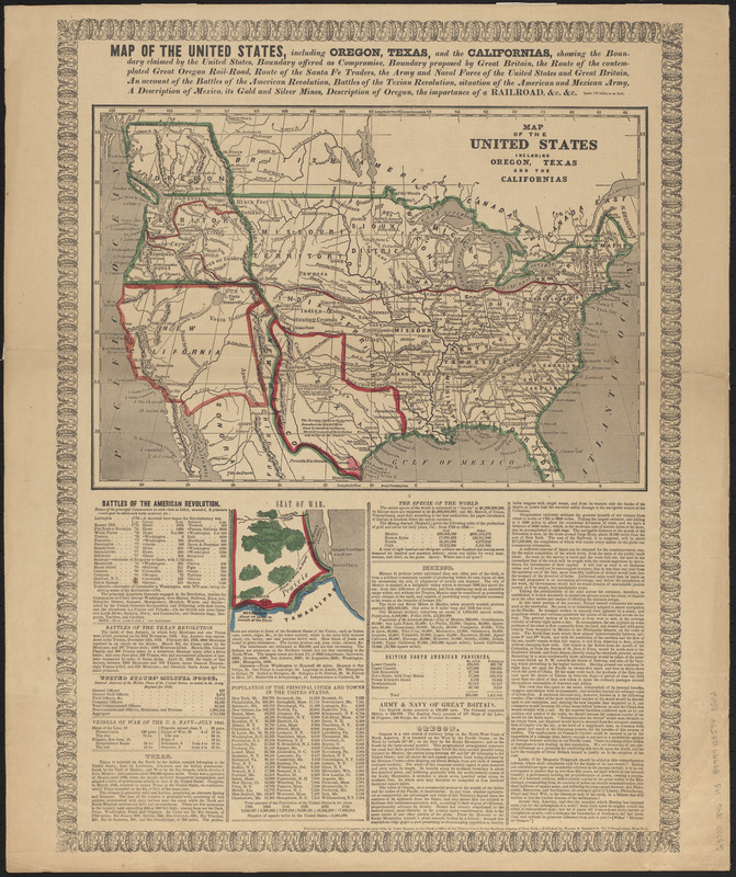
Relief shown by hachures.
Prime meridians: Greenwich and Washington.
Map of the United States showing various proposed and anticipated boundaries.
"Entered according to Act of Congress, in the year 1846, by John Haven, in the clerk's office of the District Court for the Southern District of New York."
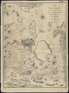
Includes ancillary map showing the seat of war in the Mexican-American War, population figures, military statistics, and text describing battles and areas of expansion.
Notes (date):
This date is inferred.
Notes (citation):
Wheat, C.I. Mapping the transmississippi West, 514