Skip to search
Skip to main content
Digital Commonwealth
Sign Up / Log In
Search for
Search
Search
Search
Basic
Advanced
Explore
Map
Collections
Institutions
Formats
For Educators
Primary Source Sets
Lesson Plans
Using Primary Sources
Searching Digital Commonwealth
For Institutions
Join Digital Commonwealth
Conferences, Trainings, & Events
How to Contribute Collections
Digitization Services
Board & Committees
Frequently Asked Questions
About
About Digital Commonwealth
News & Announcements
Copyright & Terms of Use
Harmful Content Statement
Partners
API
Contact Us
Boston Public Library
Norman B. Leventhal Map Center Collection
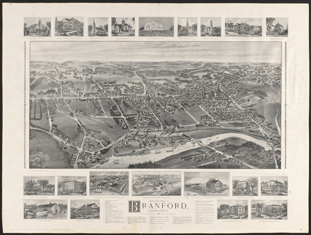
Bird's-eye view of Branford, Connecticut
Birds-eye view of Branford, Connecticut
×
Item Information
Title:
Bird's-eye view of Branford, Connecticut
Cartographer:
Hughes & Bailey
Date:
1905
Format:
Maps/Atlases
Location:
Boston Public Library
Norman B. Leventhal Map Center
Collection (local):
Norman B. Leventhal Map Center Collection
Subjects:
Branford (Conn.)--Aerial views
Places:
New Haven (county)
>
Branford
Extent:
1 view ; 34 x 67 cm, on sheet 65 x 84 cm
Permalink:
https://ark.digitalcommonwealth.org/ark:/50959/0r96fp158
Terms of Use:
No known copyright restrictions.
No known restrictions on use.
Publisher:
New York : Hughes & Bailey, Publishers
Scale:
Not drawn to scale
Language:
English
Notes:
Relief shown pictorially.
Includes illustrations of buildings and index to points of interest.
Identifier:
06_01_016054
Call #:
G3784.B599A3 1905 .H84
Barcode:
39999085941779
show more...
View MODS XML
More Like This
The 100th anniversary map of Abraham Lincoln's visit to ...
1630 shoreline
1879. Progress map of the U.S. Geographical Surveys west of the ...
1903 Map of Salem and surrounding places
Find More Like This >>
Tools
Share
Facebook
Pinterest
X
Reddit
Tumblr
Email
Copy link
Add to Folder
Questions/Comments
Cite This Item
IIIF Manifest
Downloads
Primary (full resolution, uncompressed)
(TIF, 132 MB)
Large (full resolution)
(JPEG, 11.1 MB)
Medium
(JPEG, 331 KB)