Skip to search
Skip to main content
Digital Commonwealth
Sign Up / Log In
Search for
Search
Search
Search
Basic
Advanced
Explore
Map
Collections
Institutions
Formats
For Educators
Primary Source Sets
Lesson Plans
Using Primary Sources
Searching Digital Commonwealth
For Institutions
Join Digital Commonwealth
Conferences, Trainings, & Events
How to Contribute Collections
Digitization Services
Board & Committees
Frequently Asked Questions
About
About Digital Commonwealth
News & Announcements
Copyright & Terms of Use
Harmful Content Statement
Partners
API
Contact Us
Boston Public Library
Norman B. Leventhal Map Center Collection
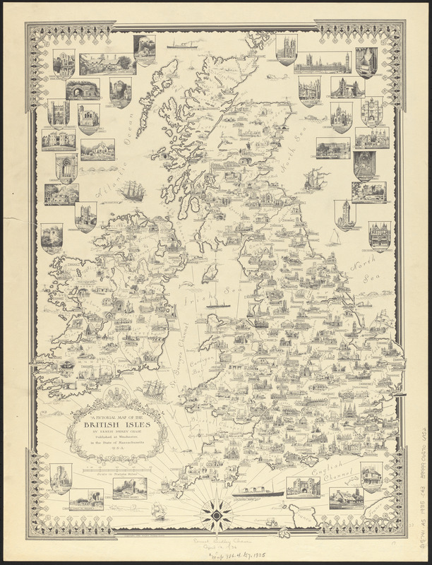
A pictorial map of the British Isles
A pictorial map of the British Isles
×
Item Information
Title:
A pictorial map of the British Isles
Cartographer:
Chase, Ernest Dudley, 1878-1966
Name on Item:
by Ernest Dudley Chase
Date:
1935
Format:
Maps/Atlases
Location:
Boston Public Library
Norman B. Leventhal Map Center
Collection (local):
Norman B. Leventhal Map Center Collection
Subjects:
Great Britain--Maps
Places:
United Kingdom
>
Great Britain
(island)
Extent:
1 map ; 58 x 42 cm
Permalink:
https://ark.digitalcommonwealth.org/ark:/50959/0r96fn16b
Terms of Use:
No known copyright restrictions.
No known restrictions on use.
Publisher:
Winchester, Mass. : [Ernest Dudley Chase]
Scale:
Scale approximately 1:1,680,000
Language:
English
Notes:
Relief shown pictorially.
Pictorial map.
Includes illustrations.
Identifier:
06_01_014785
Call #:
G5741.A5 1935 .C43
Barcode:
39999065706952
show more...
View MODS XML
More Like This
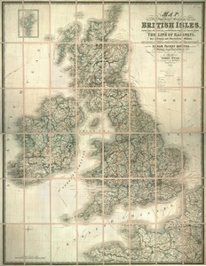
Bradshaw's new map of the railways in Great Britain for 1872
Great Britain, her natural & industrial resources
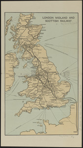
London Midland and Scottish Railway
Map of the superficial geology of the British Isles with the ...
Find More Like This >>
Tools
Share
Facebook
Pinterest
X
Reddit
Tumblr
Email
Copy link
Add to Folder
Questions/Comments
Cite This Item
IIIF Manifest
Downloads
Primary (full resolution, uncompressed)
(TIF, 76.5 MB)
Large (full resolution)
(JPEG, 6.42 MB)
Medium
(JPEG, 251 KB)