Skip to search
Skip to main content
Digital Commonwealth
Sign Up / Log In
Search for
Search
Search
Search
Basic
Advanced
Explore
Map
Collections
Institutions
Formats
For Educators
Primary Source Sets
Lesson Plans
Using Primary Sources
Searching Digital Commonwealth
For Institutions
Join Digital Commonwealth
Conferences, Trainings, & Events
How to Contribute Collections
Digitization Services
Board & Committees
Frequently Asked Questions
About
About Digital Commonwealth
News & Announcements
Copyright & Terms of Use
Harmful Content Statement
Partners
API
Contact Us
Boston Public Library
Norman B. Leventhal Map Center Collection
/
Boston and New England Maps (Collection of Distinction)
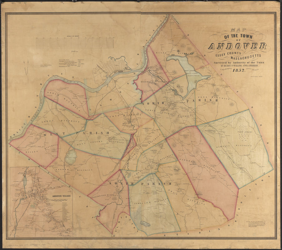
Map of the town of Andover, Essex County, Massachusetts
Map of the town of Andover, Essex County, Massachusetts
×
Item Information
Title:
Map of the town of Andover, Essex County, Massachusetts
Cartographer:
Walling, Henry Francis, 1825-1888
Lithographer:
Kollner, Augustus, 1813-1906
Name on Item:
surveyed by authority of the town by Henry F. Walling, civil engineer
Date:
1852
Format:
Maps/Atlases
Location:
Boston Public Library
Norman B. Leventhal Map Center
Collection (local):
Norman B. Leventhal Map Center Collection
Subjects:
Landowners--Massachusetts--Andover (Town)--Maps
Landowners--Massachusetts--North Andover--Maps
Andover (Mass. : Town)--Maps
Lawrence (Mass.)--Maps
North Andover (Mass.)--Maps
Places:
Essex (county)
>
Andover
Essex (county)
>
Lawrence
Essex (county)
>
North Andover
Extent:
1 map : hand color ; 88 x 105 cm
Permalink:
https://ark.digitalcommonwealth.org/ark:/50959/0r96fm02s
Terms of Use:
No known copyright restrictions.
No known restrictions on use.
Publisher:
Boston : Henry F. Walling
Scale:
Scale 1:18,000
Language:
English
Notes:
Shows school districts, parishes and property owners.
Relief shown by hachures.
Inset: Andover Village.
Includes statistics for the town.
Identifier:
06_01_014389
Call #:
G3764.A62 1852 .W35
Barcode:
39999065702936
show more...
View MODS XML
More Like This
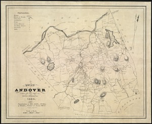
A plan of Andover taken for the town
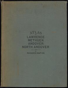
Atlas of the city of Lawrence and the towns of Methuen, Andover ...
Atlas of Essex County, Massachusetts
Atlas of the city of Lawrence and the towns of Methuen, Andover ...
Find More Like This >>
Tools
Share
Facebook
Pinterest
X
Reddit
Tumblr
Email
Copy link
Add to Folder
Questions/Comments
Cite This Item
IIIF Manifest
Downloads
Primary (full resolution, uncompressed)
(TIF, 195 MB)
Large (full resolution)
(JPEG, 16.4 MB)
Medium
(JPEG, 277 KB)
GeoTIFF (georeferenced)
(TIF, 180 MB)