Skip to search
Skip to main content
Digital Commonwealth
Sign Up / Log In
Search for
Search
Search
Search
Basic
Advanced
Explore
Map
Collections
Institutions
Formats
For Educators
Primary Source Sets
Lesson Plans
Using Primary Sources
Searching Digital Commonwealth
For Institutions
Join Digital Commonwealth
Conferences, Trainings, & Events
How to Contribute Collections
Digitization Services
Board & Committees
Frequently Asked Questions
About
About Digital Commonwealth
News & Announcements
Copyright & Terms of Use
Harmful Content Statement
Partners
API
Contact Us
Boston Public Library
Norman B. Leventhal Map Center Collection
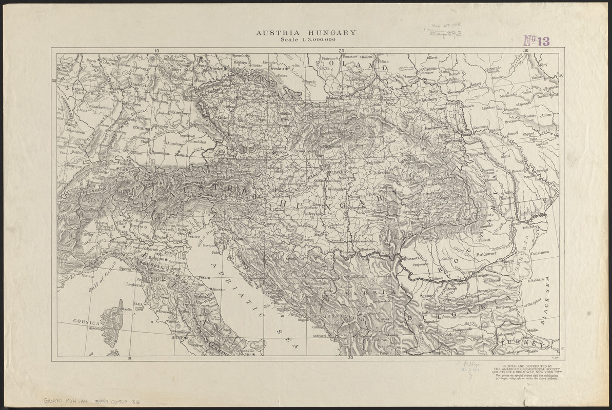
Austria Hungary
Austria Hungary
×
Item Information
Title:
Austria Hungary
Publisher:
American Geographical Society of New York
Date:
[1914?]
Format:
Maps/Atlases
Location:
Boston Public Library
Norman B. Leventhal Map Center
Collection (local):
Norman B. Leventhal Map Center Collection
Subjects:
Austria--Maps
Hungary--Maps
Places:
Austria
Hungary
Extent:
1 map ; 39 x 64 cm
Permalink:
https://ark.digitalcommonwealth.org/ark:/50959/0r96fk728
Terms of Use:
No known copyright restrictions.
No known restrictions on use.
Publisher:
New York City : American Geographical Society
Scale:
Scale 1:3,000,000
Language:
English
Notes:
Relief shown by hachures.
Identifier:
06_01_014132
Call #:
G6480 1914 .A4
Barcode:
39999065699116
show more...
View MODS XML
More Like This
Austria Hungary
Austria-Hungary
Eisenbahnkarte von Österreich-Ungarn
Eastern Hungary
Find More Like This >>
Tools
Share
Facebook
Pinterest
X
Reddit
Tumblr
Email
Copy link
Add to Folder
Questions/Comments
Cite This Item
IIIF Manifest
Downloads
Primary (full resolution, uncompressed)
(TIF, 94.4 MB)
Large (full resolution)
(JPEG, 7.93 MB)
Medium
(JPEG, 410 KB)
GeoTIFF (georeferenced)
(TIF, 71.4 MB)