Skip to search
Skip to main content
Digital Commonwealth
Sign Up / Log In
Search for
Search
Search
Search
Basic
Advanced
Explore
Map
Collections
Institutions
Formats
For Educators
Primary Source Sets
Lesson Plans
Using Primary Sources
Searching Digital Commonwealth
For Institutions
Join Digital Commonwealth
Conferences, Trainings, & Events
How to Contribute Collections
Digitization Services
Board & Committees
Frequently Asked Questions
About
About Digital Commonwealth
News & Announcements
Copyright & Terms of Use
Harmful Content Statement
Partners
API
Contact Us
Salem State University Archives and Special Collections
Historic Maps
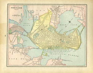
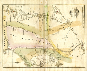
City of Portland Maine.
View this item online at Salem State University Archives and Special Collections
Item Information
Title:
City of Portland Maine.
Description:
From Cram's Universal Atlas: Geographical, Astronomical and Historical. New York: George F. Cram, 1898. Verso: Map of Boston.
Creator:
Cram, George Franklin
Date:
1898
Format:
Maps/Atlases
Location:
Salem State University Archives and Special Collections
Collection (local):
Historic Maps
Series:
Coastal or Nautical
Subjects:
Portland (Me.)--Maps
Coastal
New England
Link to Item:
http://digitalcommons.salemstate.edu/maps_newengland/7
Terms of Use:
Rights status not evaluated.
Contact host institution for more information.
Identifier:
G 3734 .P8P2C7 1871
show more...
View MODS XML
More Like This
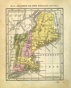
Eastern or New England States
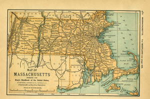
Map of Massachusetts
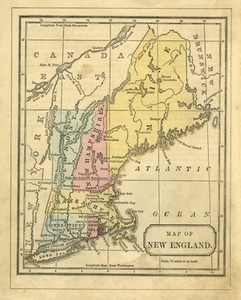
Map of New England.
A Map Of The Country Which Was The Scene Of Operations Of the ...
Find More Like This >>
Tools
Share
Facebook
Pinterest
X
Reddit
Tumblr
Email
Copy link
Add to Folder
Questions/Comments
Cite This Item