Skip to search
Skip to main content
Digital Commonwealth
Sign Up / Log In
Search for
Search
Search
Search
Basic
Advanced
Explore
Map
Collections
Institutions
Formats
For Educators
Primary Source Sets
Lesson Plans
Using Primary Sources
Searching Digital Commonwealth
For Institutions
Join Digital Commonwealth
Conferences, Trainings, & Events
How to Contribute Collections
Digitization Services
Board & Committees
Frequently Asked Questions
About
About Digital Commonwealth
News & Announcements
Copyright & Terms of Use
Harmful Content Statement
Partners
API
Contact Us
Salem State University Archives and Special Collections
Historic Maps
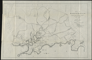
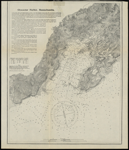
Map of Manchester, Mass.
View this item online at Salem State University Archives and Special Collections
Item Information
Title:
Map of Manchester, Mass.
Description:
Originally folded 20 x 8 cm. Shows paved and wood roads, railways, landowners, public buildings.
Date:
1895
Format:
Maps/Atlases
Location:
Salem State University Archives and Special Collections
Collection (local):
Historic Maps
Series:
Essex County
Subjects:
Manchester (Mass.)--Maps
Massachusetts--Maps
Boston and Maine Railroad
Manchester
Hamilton
Wenham
Beverly
Gloucester
Essex
Essex Woods
Wyman's Hill
Eagle Head
Old Neck
Singing Beach
Glass Head
Black Cove
Graves Island
Graves Beach
White Beach
Kettle Cove
Magnolia Depot
Moses Hill
Ice Pond
Little Egg Rock
Salt Rock
Ram Islands
Gales Point
Tucks Point
Lobster Cove
Essex county
Massachusetts
Places:
Massachusetts
>
Essex (county)
>
Manchester
Link to Item:
http://digitalcommons.salemstate.edu/maps_essexcounty/70
Terms of Use:
Rights status not evaluated.
Contact host institution for more information.
Identifier:
G 3764 .M23 1895 .M2
show more...
View MODS XML
More Like This
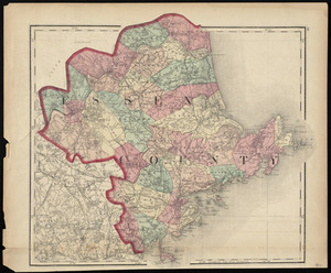
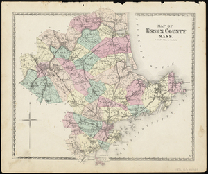
Essex County
Map of Essex County Mass.
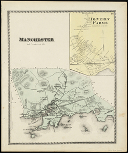
Manchester
Gloucester Harbor, Massachusetts
Find More Like This >>
Tools
Share
Facebook
Pinterest
X
Reddit
Tumblr
Email
Copy link
Add to Folder
Questions/Comments
Cite This Item