Skip to search
Skip to main content
Digital Commonwealth
Sign Up / Log In
Search for
Search
Search
Search
Basic
Advanced
Explore
Map
Collections
Institutions
Formats
For Educators
Primary Source Sets
Lesson Plans
Using Primary Sources
Searching Digital Commonwealth
For Institutions
Join Digital Commonwealth
Conferences, Trainings, & Events
How to Contribute Collections
Digitization Services
Board & Committees
Frequently Asked Questions
About
About Digital Commonwealth
News & Announcements
Copyright & Terms of Use
Harmful Content Statement
Partners
API
Contact Us
Salem State University Archives and Special Collections
Historic Maps
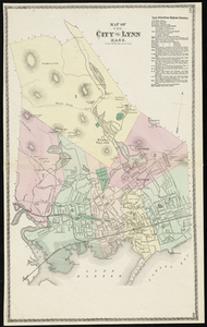
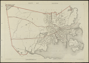
Map of the City of Lynn Mass.
View this item online at Salem State University Archives and Special Collections
Item Information
Title:
Map of the City of Lynn Mass.
Description:
Relief shown by hachures. Oriented with north toward the upper right. Includes inset of Wyoma Village.
Creator:
D.G. Beers & Co
Date:
1872
Format:
Maps/Atlases
Location:
Salem State University Archives and Special Collections
Collection (local):
Historic Maps
Series:
Essex County
Subjects:
Real property--Massachusetts--Lynn--Maps
Landowners--Massachusetts--Lynn--Maps
Lynn (Mass.)--Maps
Lynn
Lynn Harbor
Nahant Bay
Saugus River
Wyoma Lake
Wenuchus Lake
Cedar Lake
Glenmere
Breeds Pond
City Reservoir
Massachusetts
Essex county
Places:
Massachusetts
>
Essex (county)
>
Lynn
Link to Item:
http://digitalcommons.salemstate.edu/maps_essexcounty/23
Terms of Use:
Rights status not evaluated.
Contact host institution for more information.
Identifier:
G 3764 .L9 1872
show more...
View MODS XML
More Like This
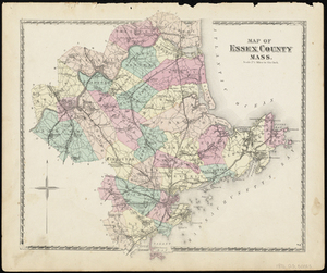
Map of Essex County Mass.
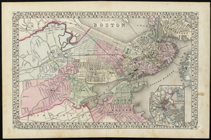
Plan of Boston
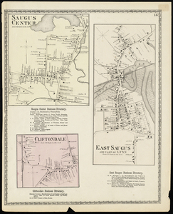
Saugus Center
City of Salem Mass.
Find More Like This >>
Tools
Share
Facebook
Pinterest
X
Reddit
Tumblr
Email
Copy link
Add to Folder
Questions/Comments
Cite This Item