Skip to search
Skip to main content
Digital Commonwealth
Sign Up / Log In
Search for
Search
Search
Search
Basic
Advanced
Explore
Map
Collections
Institutions
Formats
For Educators
Primary Source Sets
Lesson Plans
Using Primary Sources
Searching Digital Commonwealth
For Institutions
Join Digital Commonwealth
Conferences, Trainings, & Events
How to Contribute Collections
Digitization Services
Board & Committees
Frequently Asked Questions
About
About Digital Commonwealth
News & Announcements
Copyright & Terms of Use
Harmful Content Statement
Partners
API
Contact Us
State Library of Massachusetts
Massachusetts Board of Railroad Commissioners
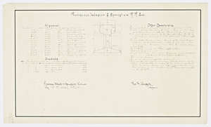
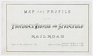
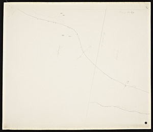
Map and profile of the Providence, Webster and Springfield railroad extension.
View this item online at State Library of Massachusetts
Item Information
Title:
Map and profile of the Providence, Webster and Springfield railroad extension.
Date:
1883
Format:
Maps/Atlases
Location:
State Library of Massachusetts
Collection (local):
Massachusetts Board of Railroad Commissioners
Series:
Maps
Subjects:
Providence, Webster and Springfield Railroad
Dudley, Mass.--Maps--1883
Places:
Massachusetts
>
Worcester (county)
>
Webster
Massachusetts
>
Worcester (county)
>
Dudley
Extent:
2 maps 29 1/2 x 18 in. + 1 p. of engineering statistics.
Link to Item:
http://archives.lib.state.ma.us/handle/2452/50739
Terms of Use:
Rights status not evaluated.
Contact host institution for more information.
Notes:
Date ca. 1883 from report of the Railroad filed with the Mass. Railroad Commission.
Map Mass. R.R. 1883 #324
Identifier:
esl40029021
show more...
View MODS XML
More Like This
Map and profile of the Providence, Webster and Springfield railroad.
Act of incorporation for the Dorchester and Milton Extension ...
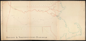
Boston & Northwestern Railroad.
Boston and Hudson River railroad surveys / Wm C. Young, engineer.
Find More Like This >>
Tools
Share
Facebook
Pinterest
X
Reddit
Tumblr
Email
Copy link
Add to Folder
Questions/Comments
Cite This Item