Skip to search
Skip to main content
Digital Commonwealth
Sign Up / Log In
Search for
Search
Search
Search
Basic
Advanced
Explore
Map
Collections
Institutions
Formats
For Educators
Primary Source Sets
Lesson Plans
Using Primary Sources
Searching Digital Commonwealth
For Institutions
Join Digital Commonwealth
Conferences, Trainings, & Events
How to Contribute Collections
Digitization Services
Board & Committees
Frequently Asked Questions
About
About Digital Commonwealth
News & Announcements
Copyright & Terms of Use
Harmful Content Statement
Partners
API
Contact Us
State Library of Massachusetts
Massachusetts Board of Railroad Commissioners
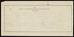
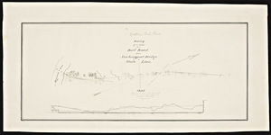
Plan of the premises of the Boston and Maine and Eastern railroads in the city of Boston north of Causeway Street.
View this item online at State Library of Massachusetts
Item Information
Title:
Plan of the premises of the Boston and Maine and Eastern railroads in the city of Boston north of Causeway Street.
Contributor:
L.H. Bradford & Co
Date:
1861
Format:
Maps/Atlases
Location:
State Library of Massachusetts
Collection (local):
Massachusetts Board of Railroad Commissioners
Series:
Maps
Subjects:
Boston and Maine Railroad
Eastern Railroad
Boston (Mass.)--Maps
Places:
Massachusetts
>
Suffolk (county)
>
Boston
Extent:
1 map 24 x 10 in.
Link to Item:
http://archives.lib.state.ma.us/handle/2452/50665
Terms of Use:
Rights status not evaluated.
Contact host institution for more information.
Publisher:
L.H. Bradford, lithographer
Notes:
Map Mass. R.R. 1861 #201
Identifier:
esl10133478
show more...
View MODS XML
More Like This
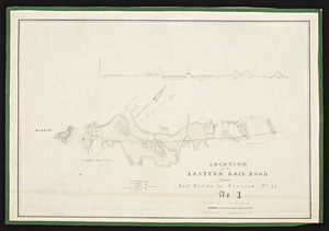
Location of the Eastern Railroad from East Boston to the Merrimack ...
Plan for the Eastern R.R. extension through Charlestown.
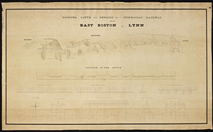
Proposed route and details for a suspension railway from East ...
A survey of a route for a railroad from Newburyport Bridge to ...
Find More Like This >>
Tools
Share
Facebook
Pinterest
X
Reddit
Tumblr
Email
Copy link
Add to Folder
Questions/Comments
Cite This Item