Skip to search
Skip to main content
Digital Commonwealth
Sign Up / Log In
Search for
Search
Search
Search
Basic
Advanced
Explore
Map
Collections
Institutions
Formats
For Educators
Primary Source Sets
Lesson Plans
Using Primary Sources
Searching Digital Commonwealth
For Institutions
Join Digital Commonwealth
Conferences, Trainings, & Events
How to Contribute Collections
Digitization Services
Board & Committees
Frequently Asked Questions
About
About Digital Commonwealth
News & Announcements
Copyright & Terms of Use
Harmful Content Statement
Partners
API
Contact Us
State Library of Massachusetts
Massachusetts Board of Harbor and Land Commissioners
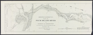
Plan of Plum Island River in Newbury and Newburyport
View this item online at State Library of Massachusetts
Item Information
Title:
Plan of Plum Island River in Newbury and Newburyport
Contributor:
Board of Harbor and Land Commissioners of Massachusetts
Date:
1908
Format:
Maps/Atlases
Location:
State Library of Massachusetts
Collection (local):
Massachusetts Board of Harbor and Land Commissioners
Series:
Maps
Subjects:
Newbury (Mass.)--Maps
Newburyport (Mass.)--Maps
Plum Island (Newburyport, Mass.)--Maps
Places:
Massachusetts
>
Essex (county)
>
Newbury
Link to Item:
http://archives.lib.state.ma.us/handle/2452/48561
Terms of Use:
Rights status not evaluated.
Contact host institution for more information.
Publisher:
Wright and Potter
Identifier:
ocm09633096
show more...
View MODS XML
More Like This
Atlas of the boundaries of the cities of Gloucester and ...
Atlas of Essex County, Massachusetts
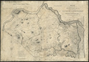
Map of the original town of Newbury, now divided into Newbury, ...
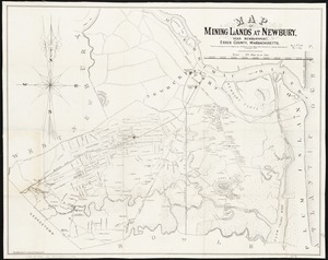
Map of mining lands at Newbury, near Newburyport, Essex County, ...
Find More Like This >>
Tools
Share
Facebook
Pinterest
X
Reddit
Tumblr
Email
Copy link
Add to Folder
Questions/Comments
Cite This Item