Skip to search
Skip to main content
Digital Commonwealth
Sign Up / Log In
Search for
Search
Search
Search
Basic
Advanced
Explore
Map
Collections
Institutions
Formats
For Educators
Primary Source Sets
Lesson Plans
Using Primary Sources
Searching Digital Commonwealth
For Institutions
Join Digital Commonwealth
Conferences, Trainings, & Events
How to Contribute Collections
Digitization Services
Board & Committees
Frequently Asked Questions
About
About Digital Commonwealth
News & Announcements
Copyright & Terms of Use
Harmful Content Statement
Partners
API
Contact Us
State Library of Massachusetts
Massachusetts Board of Harbor and Land Commissioners
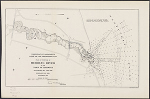
Plan of portion of Herring River in the town of Harwich
View this item online at State Library of Massachusetts
Item Information
Title:
Plan of portion of Herring River in the town of Harwich
Contributor:
Board of Harbor and Land Commissioners of Massachusetts
Date:
1901
Format:
Maps/Atlases
Location:
State Library of Massachusetts
Collection (local):
Massachusetts Board of Harbor and Land Commissioners
Series:
Maps
Subjects:
Harwich (Mass.)--Maps
Places:
Massachusetts
>
Barnstable (county)
>
Harwich
Link to Item:
http://archives.lib.state.ma.us/handle/2452/48551
Terms of Use:
Rights status not evaluated.
Contact host institution for more information.
Publisher:
Geo. H. Walker & Co.
Identifier:
ocm09383294
show more...
View MODS XML
More Like This
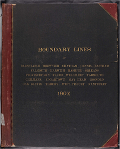
Atlas of the boundaries of the towns of Barnstable, Brewster, ...
Atlas of Barnstable County, Massachusetts : towns of Bourne, ...
Atlas of Barnstable County, Massachusetts : towns of Bourne, ...
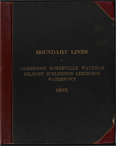
Atlas of the boundaries of the cities of Cambridge, Somerville, ...
Find More Like This >>
Tools
Share
Facebook
Pinterest
X
Reddit
Tumblr
Email
Copy link
Add to Folder
Questions/Comments
Cite This Item