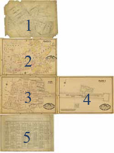
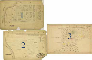
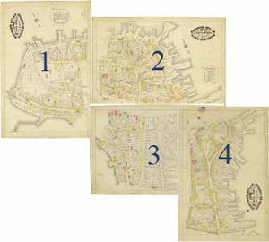
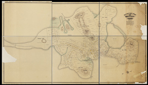
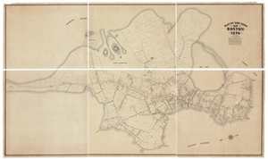
Clough's Atlas 1798 Property Owners of the Town of Boston, plates depicting the Long Wharf and Dock Square area
Description:
Plates for an atlas of Boston property owners in 1798 begun, but never completed, by Clough, and based on the Direct Tax Census of 1798. The map covers the Long Wharf and Dock Square area. 5 plates from this uncompleted atlas. From the Samuel Chester Clough research materials towards a topographical history of Boston. The fifth plate is an index of property owners for plate three.
First plate in sequence: 96 cm x 67.5 cm; second plate in sequence 91.5 cm x 61 cm; third plate in sequence: 90.5 cm x 61 cm; fourth plate in sequence: 91.5 cm x 60.5 cm; fifth plate in sequence: 98 cm x 67.5 cm
Item from the collections of the Massachusetts Historical Society. Image use and licensing information: www.masshist.org/library/permissions
Contact host institution for more information.