Skip to search
Skip to main content
Digital Commonwealth
Sign Up / Log In
Search for
Search
Search
Search
Basic
Advanced
Explore
Map
Collections
Institutions
Formats
For Educators
Primary Source Sets
Lesson Plans
Using Primary Sources
Searching Digital Commonwealth
For Institutions
Join Digital Commonwealth
Conferences, Trainings, & Events
How to Contribute Collections
Digitization Services
Board & Committees
Frequently Asked Questions
About
About Digital Commonwealth
News & Announcements
Copyright & Terms of Use
Harmful Content Statement
Partners
API
Contact Us
Massachusetts Historical Society
Selected items from the collections of the Massachusetts Historical Society
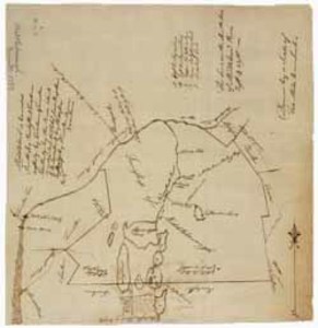
Manuscript map of the town of Middleborough, 14 June 1793
View this item online at Massachusetts Historical Society
Item Information
Title:
Manuscript map of the town of Middleborough, 14 June 1793
Description:
A manuscript map of the town of Middleborough in 1793 showing boundary lines and bodies of water.
Cartographer:
Bennett, Nehemiah
Date:
June 14, 1793
Format:
Manuscripts
Maps/Atlases
Location:
Massachusetts Historical Society
Collection (local):
Massachusetts Historical Society Collection
Subjects:
Maps, Manuscript--1793
Places:
Massachusetts
>
Plymouth (county)
>
Middleboro
Middleboro (Mass.)
Extent:
29.75 cm x 31 cm
Link to Item:
http://www.masshist.org/database/1714
Terms of Use:
Item from the collections of the Massachusetts Historical Society. Image use and licensing information: www.masshist.org/library/permissions
Contact host institution for more information.
Language:
English
Identifier:
nuview_1714
show more...
View MODS XML
More Like This
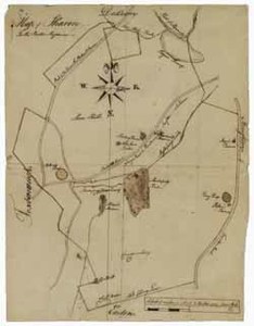
Manuscript map of Sharon, circa 1784
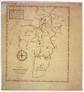
Manuscript plan of the town of Holliston, 12 February 1793
3 soldiers and one civilian walk along a street in the town of ...
38th Mass. Volunteer Infantry Regiment at Ship Island, Miss.
Find More Like This >>
Tools
Share
Facebook
Pinterest
X
Reddit
Tumblr
Email
Copy link
Add to Folder
Questions/Comments
Cite This Item