Skip to search
Skip to main content
Digital Commonwealth
Sign Up / Log In
Search for
Search
Search
Search
Basic
Advanced
Explore
Map
Collections
Institutions
Formats
For Educators
Primary Source Sets
Lesson Plans
Using Primary Sources
Searching Digital Commonwealth
For Institutions
Join Digital Commonwealth
Conferences, Trainings, & Events
How to Contribute Collections
Digitization Services
Board & Committees
Frequently Asked Questions
About
About Digital Commonwealth
News & Announcements
Copyright & Terms of Use
Harmful Content Statement
Partners
API
Contact Us
Historic New England
Nina Heald Webber Cape Cod Canal collection (MS028)
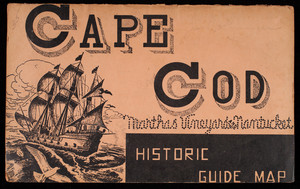
Cape Cod Historic Guide Map
View this item online at Historic New England
Item Information
Title:
Cape Cod Historic Guide Map
Description:
An undated tourist map of Cape Cod, Martha's Vineyard, and Nantucket containing illustrations of things to do, general history of the island, and points of interest.
Publisher:
New England Map Company (Somerville, Mass.)
Date:
2015
Format:
Maps/Atlases
Ephemera
Genre:
tourist maps
Location:
Historic New England
Collection (local):
MS028: Nina Heald Webber Cape Cod Canal collection
Subjects:
tourism
vacations
maps (documents)
Tourism
Places:
Barnstable (county)
>
Cod, Cape
Cape Cod Canal
Extent:
1 map
Link to Item:
http://gusn.us/324075
Terms of Use:
Rights status not evaluated.
Contact host institution for more information.
Notes:
Gift of Nina Heald Webber, 2015.
Identifier:
324075
Call #:
MS028.01.010.020
show more...
View MODS XML
More Like This
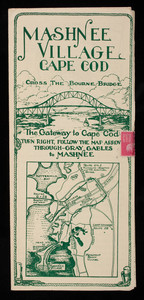
Cape Cod and Vicinity Road Map and Hotel Directory
"Cape Cod Travel Guide"
A Celebration of the Cultural & Environmental History of Cape Cod ...
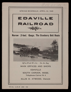
Edaville Railroad Spring Schedule, 1949
Find More Like This >>
Tools
Share
Facebook
Pinterest
X
Reddit
Tumblr
Email
Copy link
Add to Folder
Questions/Comments
Cite This Item